-
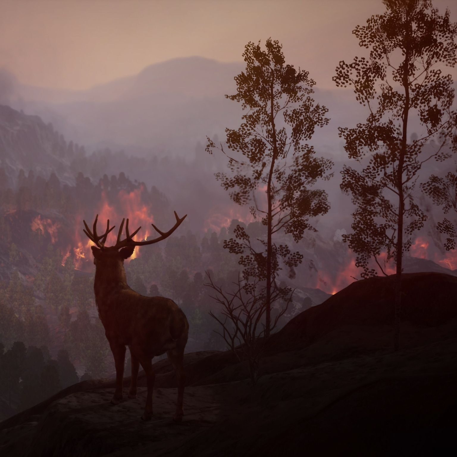
Spot the unexpected, no matter how small
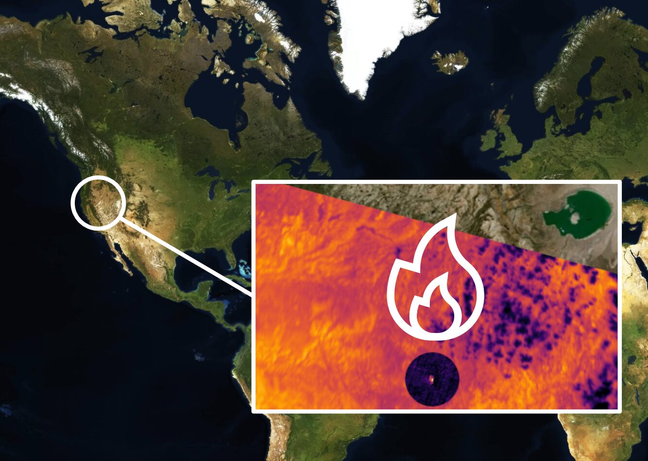
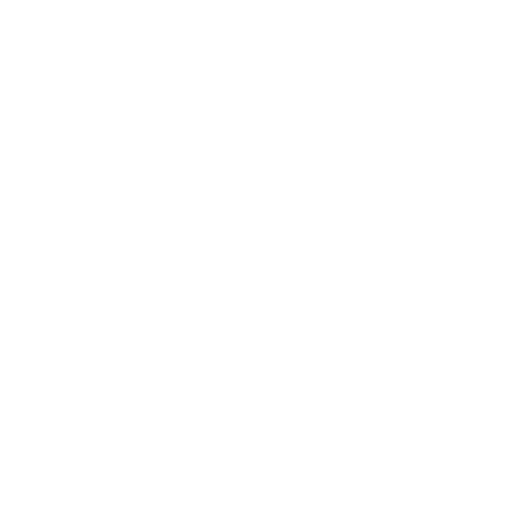
With global coverage, we find thermal anomalies to the size of a single tree: 4x4 meters.
-

3 minutes from detection to insight
And you can take action before anyone else.
-

48 Earth scans
per dayStarting with one scan today, 4 in 2024 and going up to 48 daily scans in 2026.
and Monitoring
INFRASTRUCTURE Protection

and Finance
and Food Security
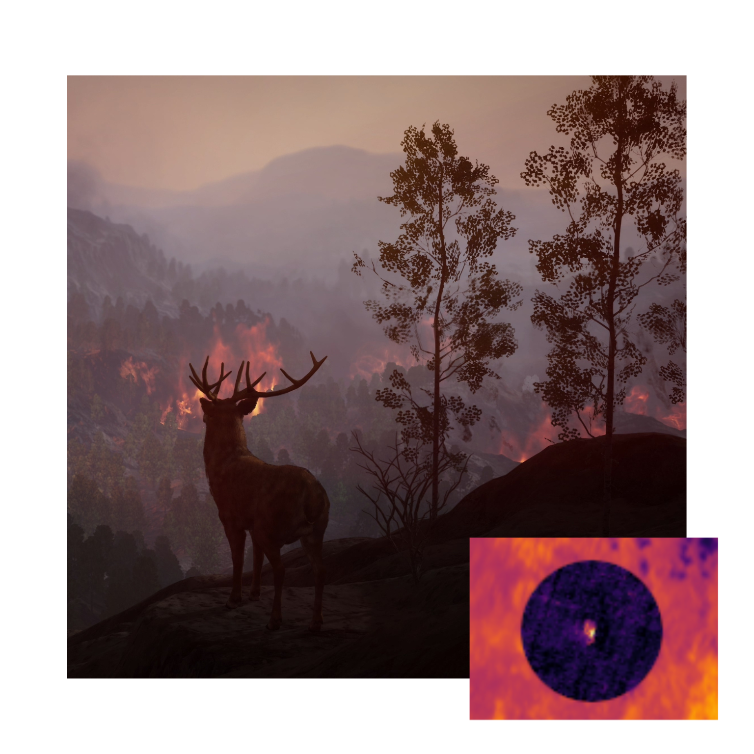
Engineering and Analysis
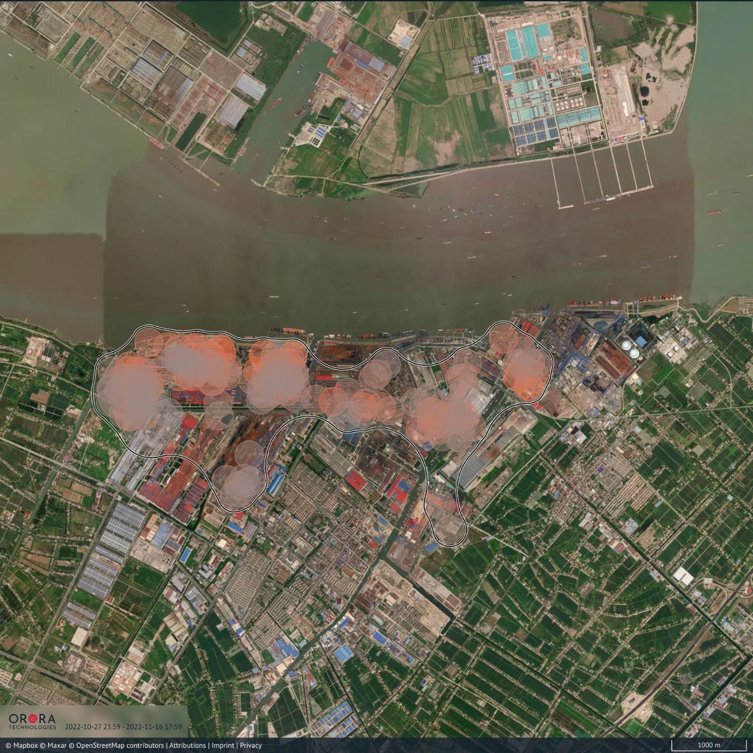
Thermal Anomaly Detection Product
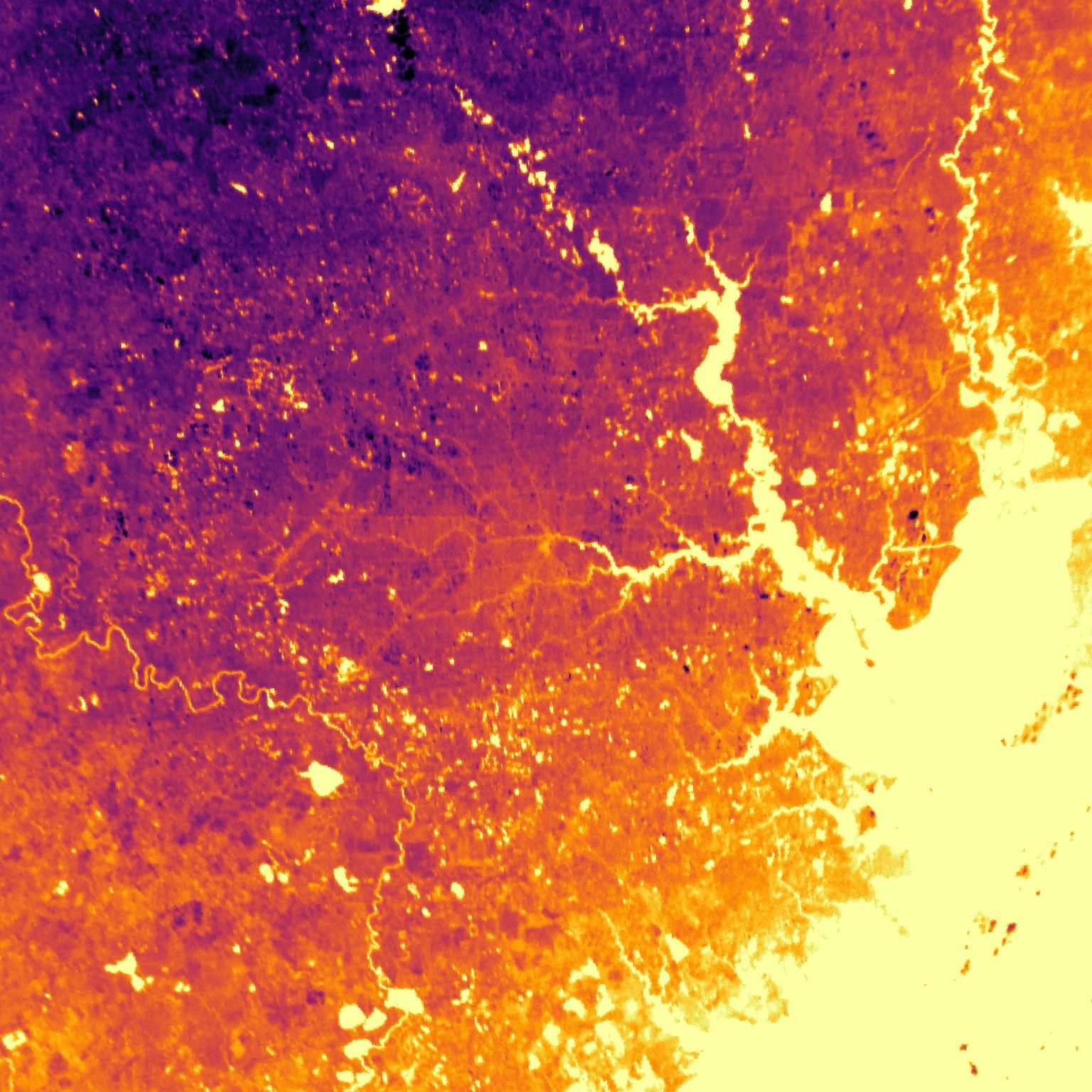
Our Thermal Anomaly Detection Product is specifically designed for super low latency detection and monitoring of natural events starting at 4x4 meters.
With a future sub-daily imaging of the whole planet, our satellite constellation is specialized on finding very hot events, such as fires, industrial processes, effects of natural resource extraction, or even human activity.
With a latency of 3 minutes from detection to insights, our data provides real-time information about temperature anomalies, allowing you to respond quickly.
Soon, we even make a 24/7 continuous video of specific locations possible, as well as running your custom detection algorithm on our satellite.
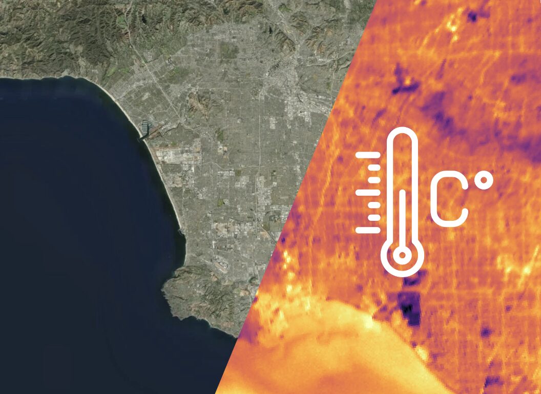
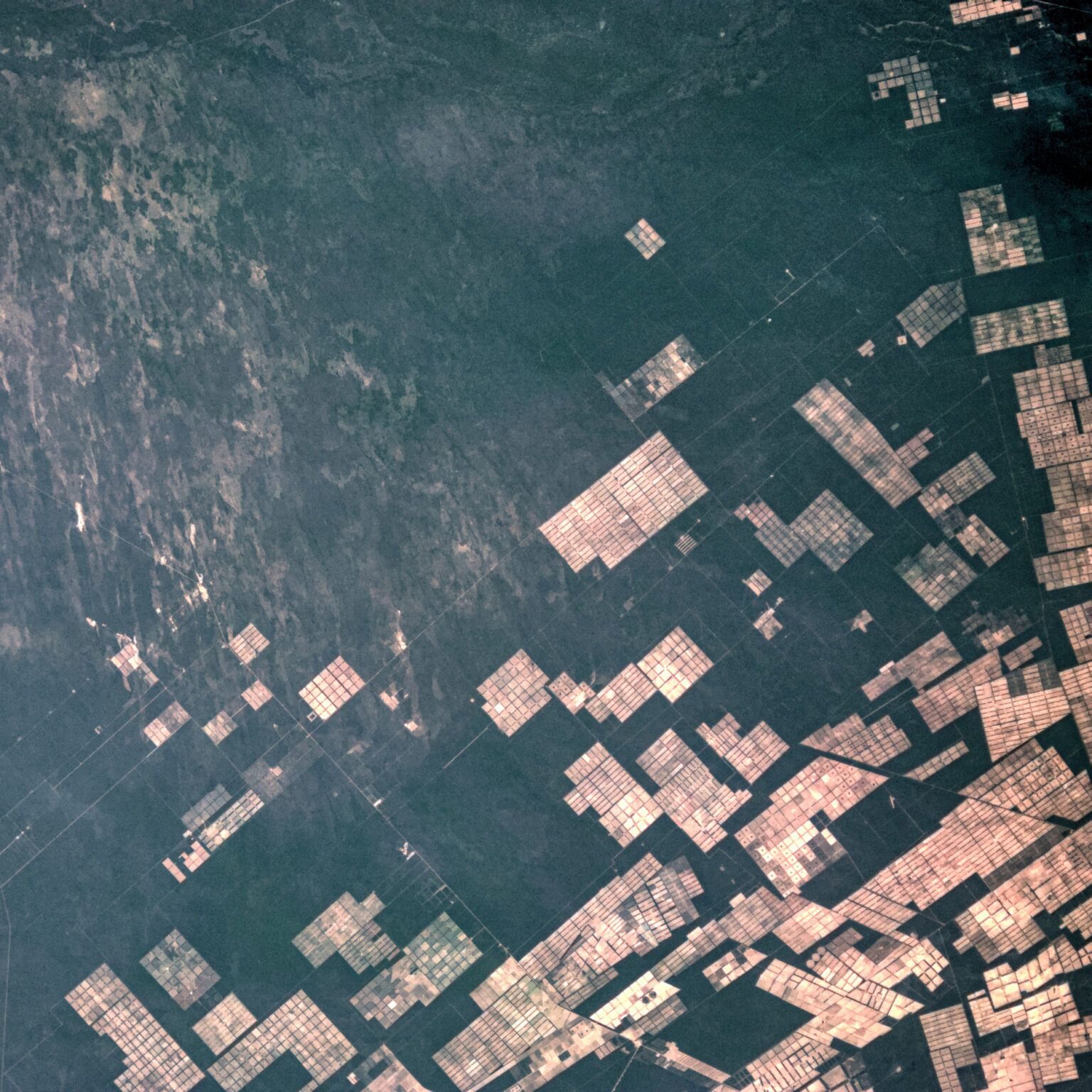
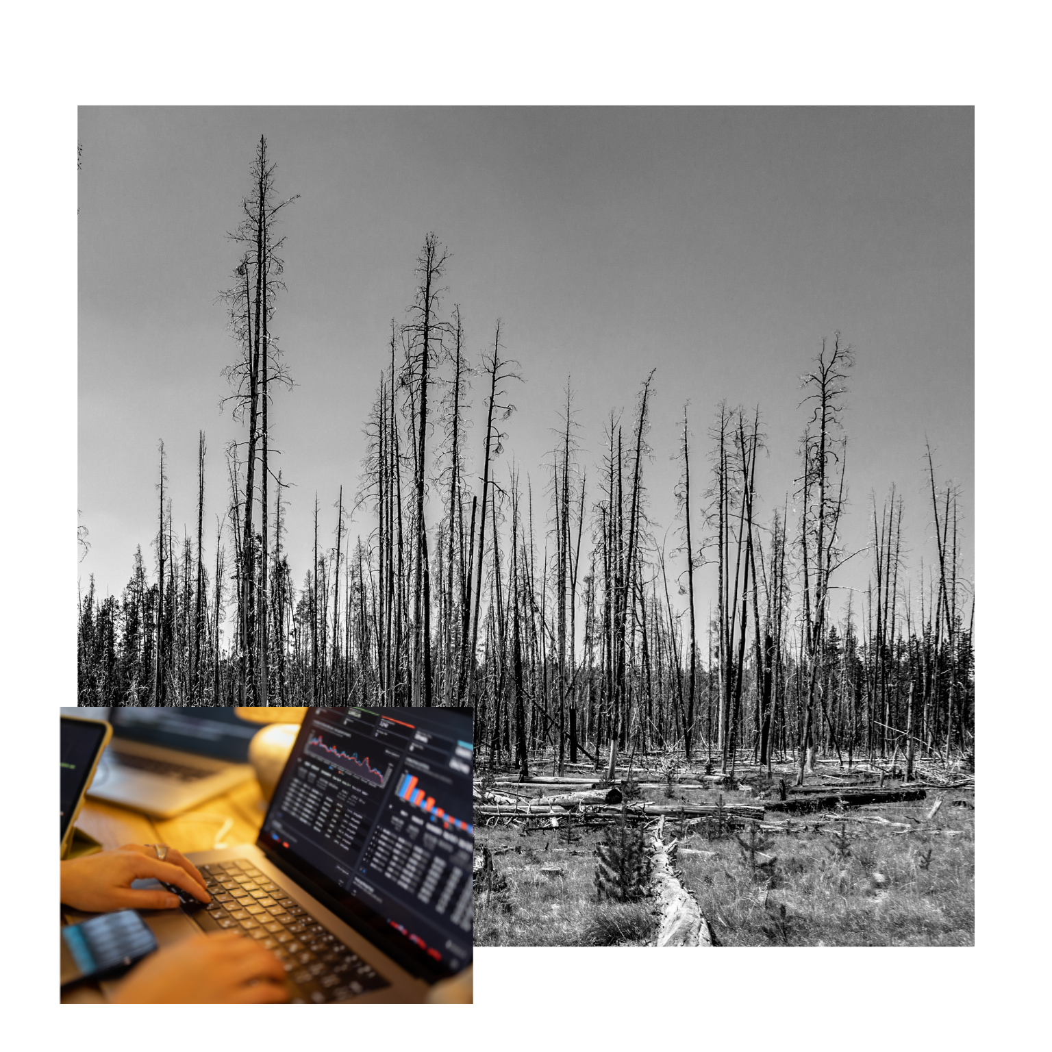
Land Surface Temperature Product
Get a clear understanding of the temperature of the Earth's surface with our satellite-based Land Surface Temperature Product.
This cutting-edge technology utilizes advanced satellite imagery with a resolution down to 80m.
Scientific calibration and validation ensures accurate capturing of the lands temperature which provides valuable insights into environmental and climate trends.
With a target temporal resolution of one image every 30 minutes of
every place on Earth, we can provide unprecedented insights into natural and artificial processes, almost completely independent of cloud coverage.

Easy API Integration
Integrate our STAC compliant API into your product or tool. Integration Service available. ArcGIS integration upon request.
Analysis Ready
Get orthorectified and georeferenced data ready to be analyzed. Just load it into your tool of choice as you would with Sentinel or Landsat data.
Calibrated & Validated
Trust in the precision of our data, knowing that every measurement has been thoroughly tested and validated for optimal results.

Available today via easy tasking request

Filling the afternoon and night gaps

Evenly distributed through day and night

Korbinian Würl
Product Manager
korbinian.wuerl@ororatech.com

Pia Feurstein
Business Development
pia.feurstein@ororatech.com

Thomas Grübler
CEO & Co-Founder
thomas.gruebler@ororatech.com
