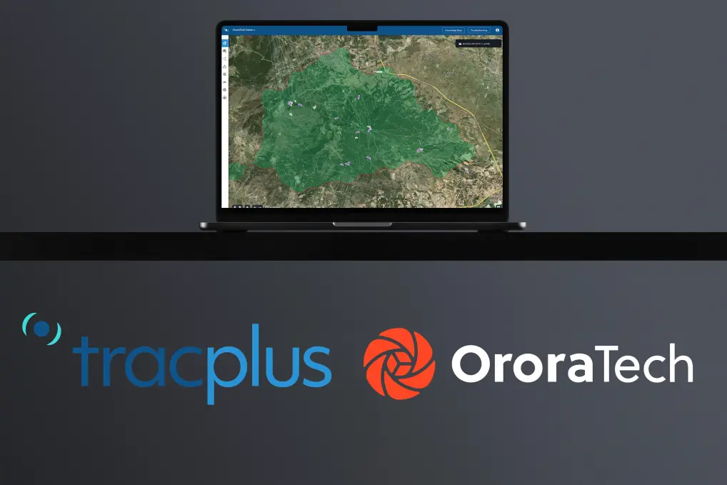
Fire Spread Case Study: OroraTech & Suzano Are Enhancing Accuracy to Protect Forest Assets
A Growing Challenge: Wildfires Across Massive Forest Holdings
As wildfire threats increase due to climate change, the need for fast, scalable, and smart detection systems is more urgent than ever. Suzano, the largest sustainable cellulose producer in South America and one of the world’s leading forestry-based businesses, manages over 2.7 million hectares (6.6 million acres) across the globe.
With eucalyptus groves averaging 266,000+ hectares per farm - nearly 780 times the size of Central Park - monitoring fire threats is not a small task. That’s where OroraTech comes in.
Suzano has been a dedicated supporter of OroraTech’s mission since 2021, being one of the first subscribers of our Wildfire Solution. Over the years, we’ve worked closely to refine our platform by constantly testing new capabilities and integrating feedback from their frontline teams.
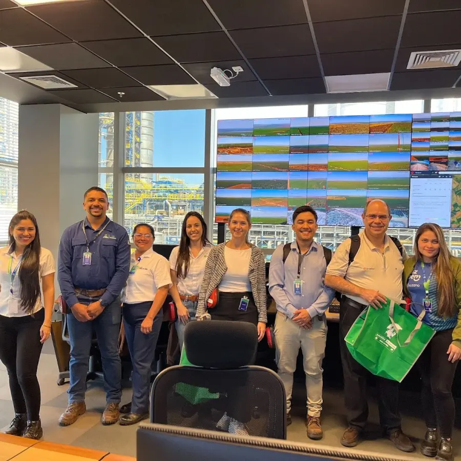
Recently, our Latin America Regional Sales Manager, Daniel Santos, and Product Manager of Wildfire Solution, Kim Feuberbacher, visited their newest and largest production plant based in Ribas do Rio Pardo, Mato Grosso do Sul, Brazil.
Fire Spread Case Study: When Seconds Matter
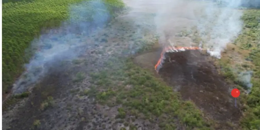
Suzano provided OroraTech with a unique opportunity to test our Fire Spread product using real-world fire events.
With satellite and drone imagery monitoring some fires in real-time, we were able to get a fantastic view of our Fire Spread capability and accuracy, allowing us to validate and refine our predictive models based on real conditions.
No fire spread algorithm will ever be perfect, because we are simulating fire behavior based on factors that can change at any moment (wind direction, wind speed, weather patterns, etc). However, by doing these case studies and determining the accuracy of our simulations, we can refine our algorithms to be the most accurate spread model on the market.
Let’s explore each of these examples and see how our Fire Spread algorithm played out in real-life scenarios:
UNF Espírito Santo – E5HV Farm
Date: July 29, 2025 | Area Burned: 50.61 ha (125.1 acres) | Type: Preservation Area
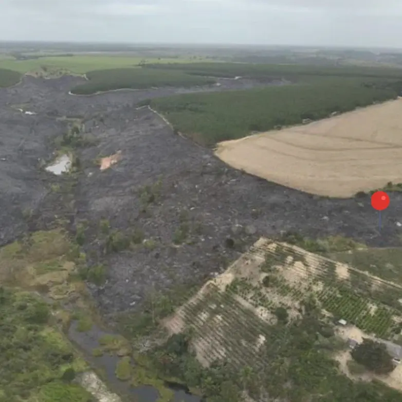
The burn scar as seen from a drone. The pin is the ignition point.
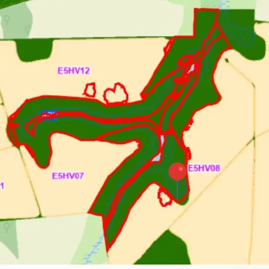
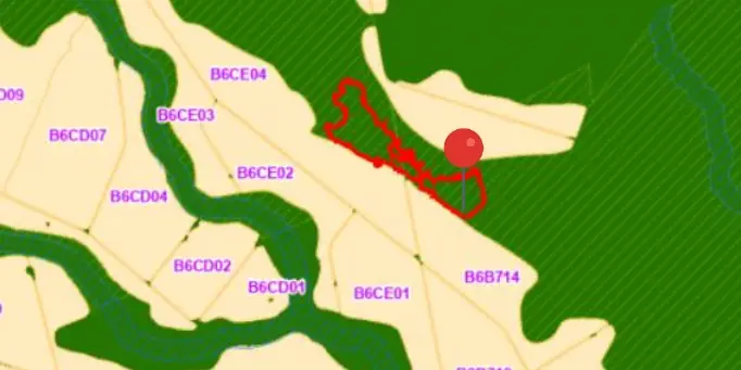
The polygon of the affected area, as drawn by Suzano engineers.
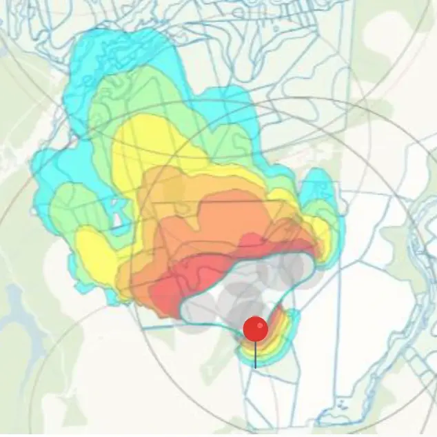
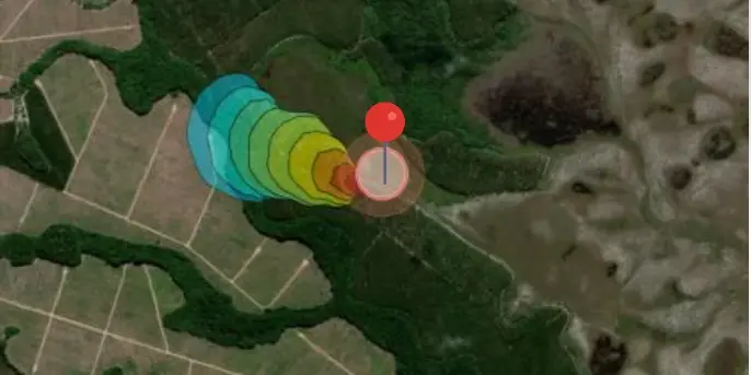
OroraTech’s Fire Spread model, with a pin to mark the ignition point.
At first blush, it may appear that our Fire Spread algorithm produced a slightly different path than the fire actually took. However, you can see in the original photo that fire breaks (also called containment lines) are protecting their plantation groves, guiding the fire in a specific direction. Due to these circumstances, we are very happy with the outcome of our simulation.
UNF BA – AparaJu Farm
Date: August 14, 2025 | Area Burned: 5.12 ha (12.65 acres)
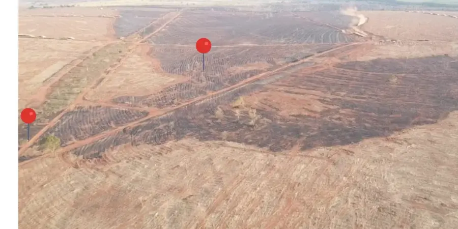
The burn scar as seen from a drone. The pin is the ignition point.
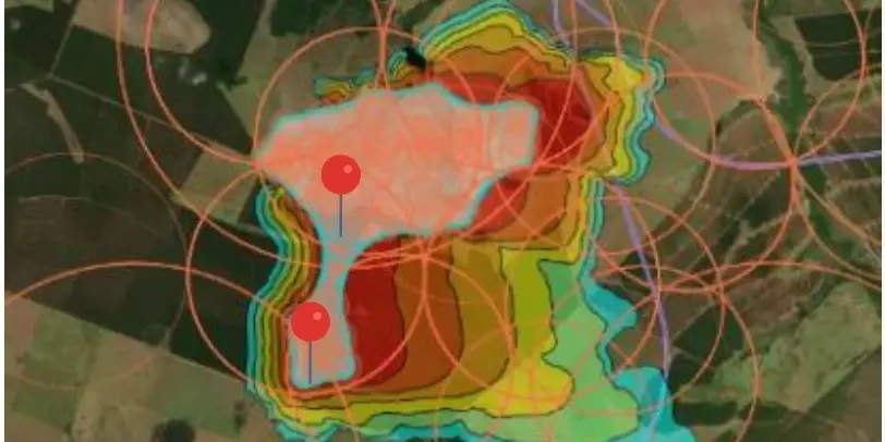
The polygon of the affected area, as drawn by Suzano engineers.
OroraTech’s Fire Spread model, with a pin to mark the ignition point.
Using drone imagery to track the fire scar and pinpoint the ignition source. As you can see, the Fire Spread simulation accurately predicted the spread and direction of the blaze.
UNF TLS – Fantasia Farm
Date: August 18, 2025 | Volume Lost: 14,993 m³ | Type: Cellulose/Residual Area
The burn scar as seen from a drone. The pins are the dual ignition points.
OroraTech’s Fire Spread model, with pins to mark ignition points.
With multiple ignition points, this incident required complex analysis. While our simulation was correct in an initial spread to the east, the shifting winds quickly pushed the fire north-northwest. You can compare the spread direction using the pins as a reference.
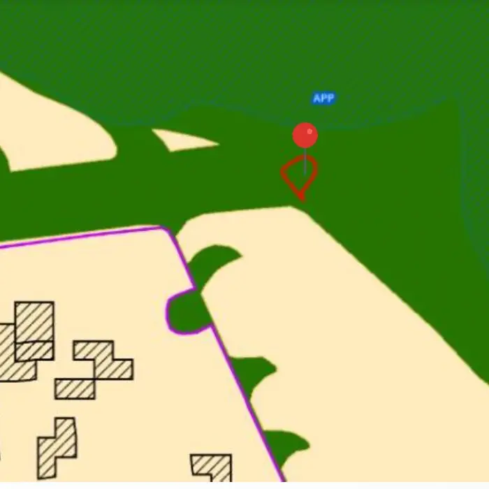
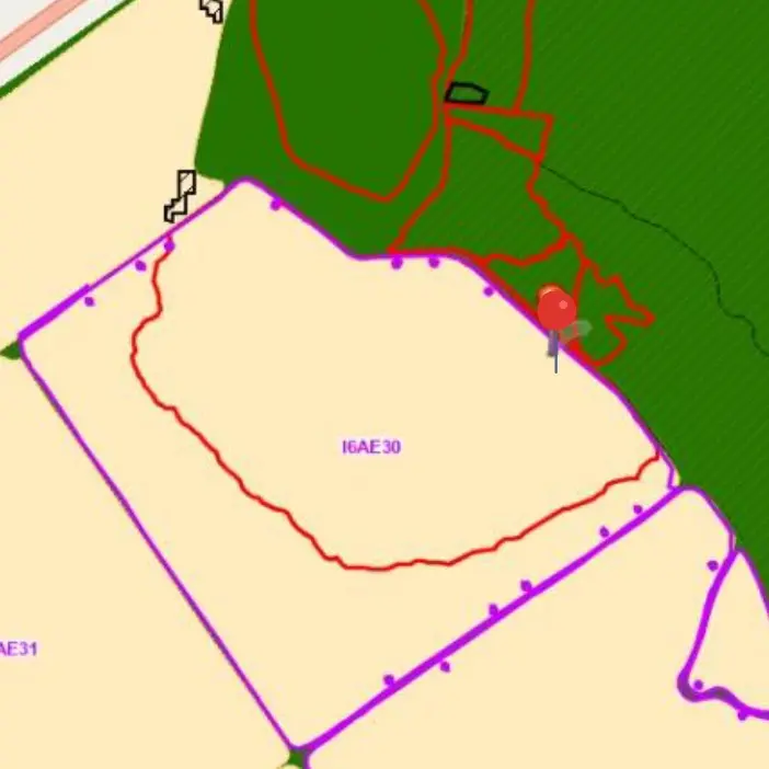
UNF Ribas do Rio Pardo – Andramil II Farm
Date: August 18, 2025 | Area Burned: 0.5 ha (1.23 acres) | Type: Preservation Area
The polygon of the affected area, as drawn by Suzano engineers.
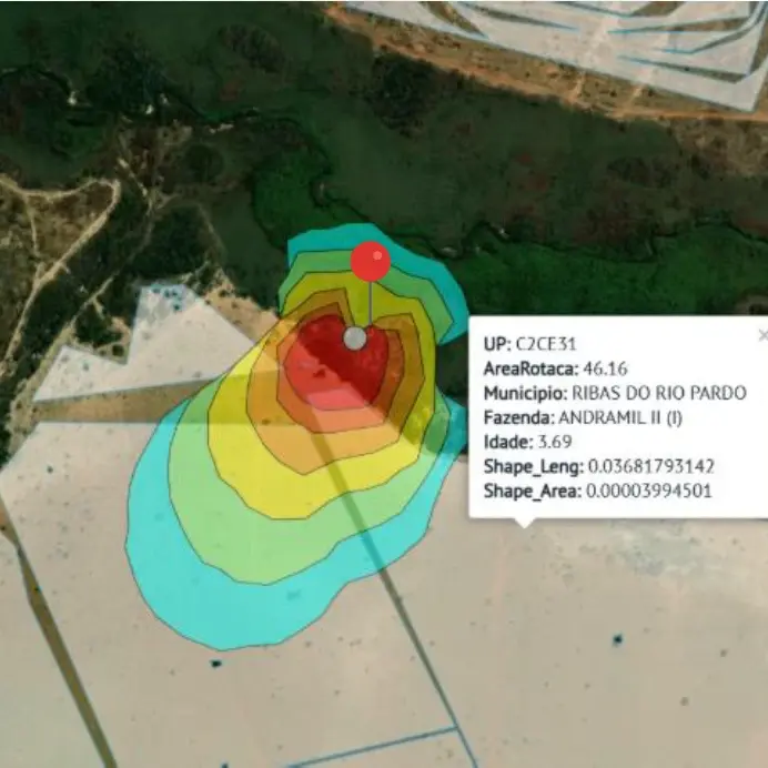
OroraTech’s Fire Spread model, with pins to mark ignition points.
Although the area was small, the simulation’s precision is spot on in this case.
UNF Maranhão – Rio Dourado Farm
Date: July 17, 2025 | Area Burned: 24.34 ha (60.15 acres) | Type: Commercial + Preservation Area
The polygon of the affected area, as drawn by Suzano engineers.
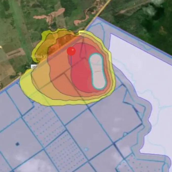
OroraTech’s Fire Spread model, with pins to mark ignition points.
In the image above, the fire unfolds almost exactly as the simulation predicted. The contours of the red burn scar line up tightly with the projected spread, a great visual showing just how closely reality followed our modeling.
UNF SP – Santa Cruz I Farm
Date: July 31, 2025 | Area Burned: 2.32 ha (5.73 acres) | Type: Commercial
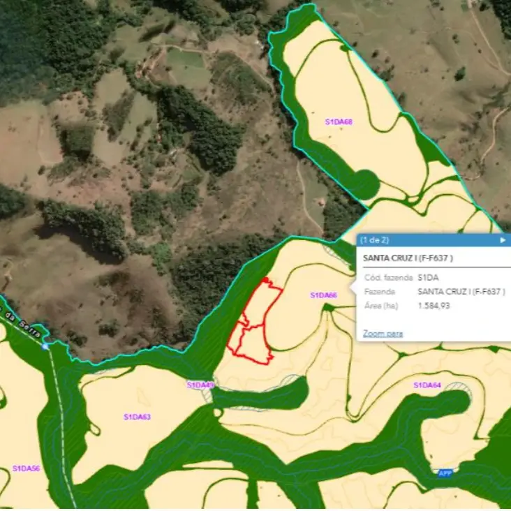
The polygon of the affected area, as drawn by Suzano engineers.
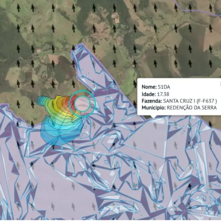
OroraTech’s Fire Spread model. The opaque circle represents the first detection.
Despite the wind moving in a different direction (the black arrows in the second screenshot), our Fire Spread solution predicted an east by southeast spread vector and was ultimately correct. While this fire was not very big, we were able to correctly guess its spread potential.
Using On-Ground Results to Drive Accurate Simulations
The collaboration between OroraTech and Suzano shows what’s possible when cutting-edge technology meets decades of on-the-ground expertise. For years, Suzano has trusted OroraTech not only as a provider but also as a partner, giving us the space to test, validate, and improve our solutions in real-world conditions. Each case study sharpens our algorithms and pushes our fire intelligence further.
While no model can predict a fire with 100% certainty, these tests prove that together we are building the most accurate and reliable fire spread simulation on the market. More importantly, they demonstrate the power of collaboration, with Suzano safeguarding millions of hectares of forest and OroraTech delivering the tools to make those efforts faster, smarter, and more effective.
Get access to our Fire Spread data
If you're managing high-risk land and want to enhance your wildfire prevention strategy:
Get in touch with our team to learn how OroraTech’s fire intelligence can protect your operations. Schedule a free consultation using the link here.
Stay in orbit with the OroraTech newsletter
Read More Stories about OroraTech