The science behind wildfire detection
Discover how OroraTech’s advanced satellite network, sensors, and AI work together to capture thermal data, detect emerging fire risks, and deliver instant alerts – empowering faster, smarter decisions.
The science behind wildfire detection
Discover how OroraTech’s advanced satellite network, sensors, and AI work together to capture thermal data, detect emerging fire risks, and deliver instant alerts – empowering faster, smarter decisions.
When every second counts: from ignition to detection
Many wildfires evade traditional detection – hidden by smoke, remote terrain, or nightfall. In these critical moments, early detection is key to stopping small flames from becoming widespread destruction.
That’s why we built OroraTech’s Wildfire Solution. Our satellite network and platform deliver the speed and precision needed to act before it’s too late.
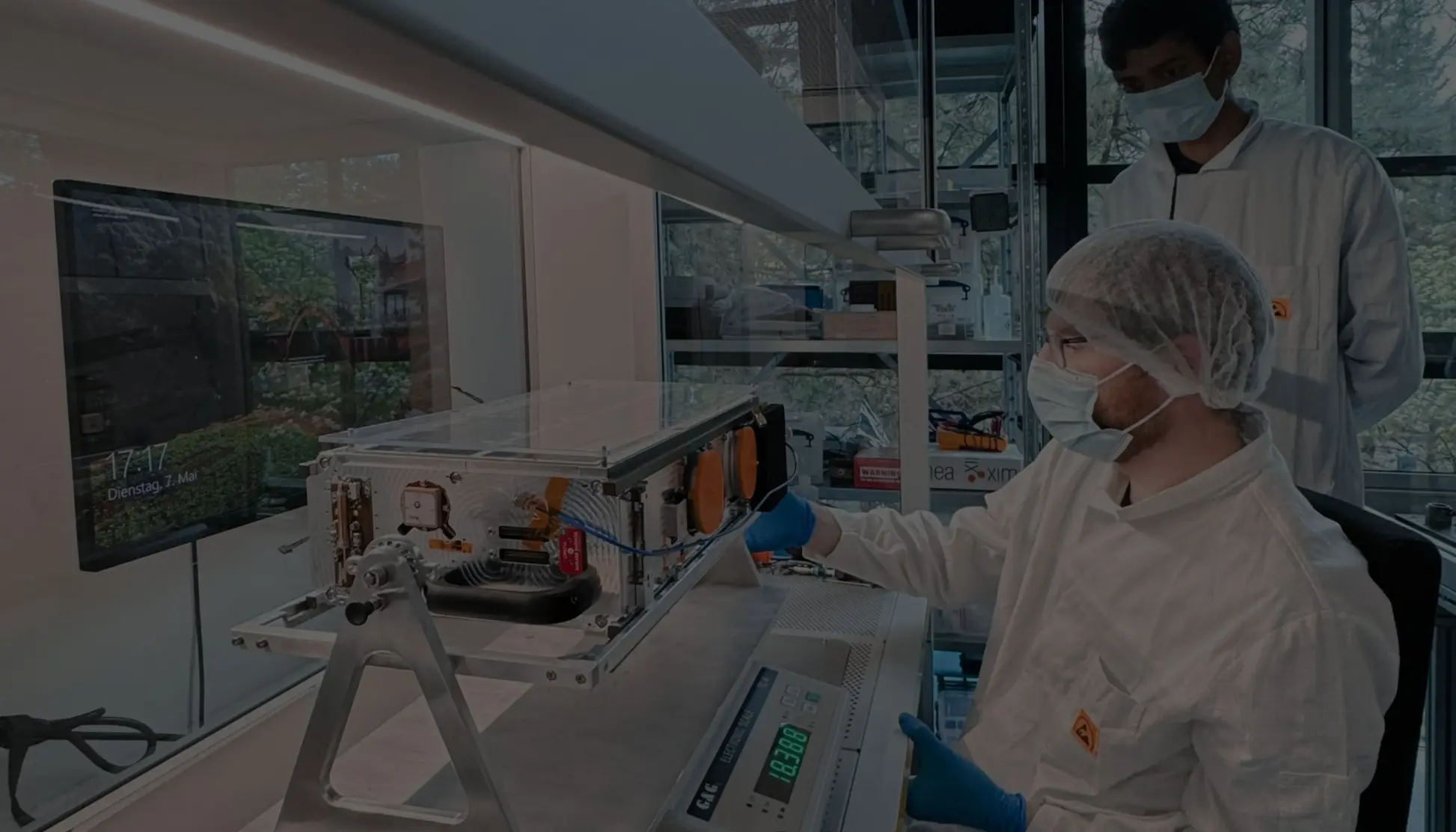
A network of eyes in the sky: thermal infrared technology for wildfire detection
At the core of OroraTech’s wildfire detection system is our patented thermal infrared camera, equipped with sensors that spot fire-specific temperature signatures. Sensitive enough to detect hotspots as small as a single tree, it ensures no fire goes unnoticed.
With high heat sensitivity and small spatial resolution, it delivers the rapid insights needed to act when every second counts.
Purpose-built payloads for instant analysis
We’re reshaping how satellite technology delivers wildfire intelligence. Unlike traditional systems that transmit bulky, unprocessed data to the ground, causing delays, we process data directly on-orbit.
By analyzing and compressing wildfire data in space, we enable near-instant alerts.
Direct downlink for faster detection
Our direct downlink technology ensures fire detection data reaches the ground faster than ever. By placing antenna stations near key customer regions, we maintain an uninterrupted connection to public satellites, eliminating delays from traditional ground stations.
This cuts processing times from hours to minutes, delivering critical wildfire intelligence when it matters most.
Regular downlink: turning raw data into actionable insights
Once critical data like fire coordinates is transmitted, we proceed with the downlink of larger datasets, including high-resolution imagery and analytics. As satellites pass over ground stations, raw sensor readings are downloaded. On-ground pipelines transform them into precise, geolocated data.
With over 100 proprietary algorithms, we analyze multiple camera types to detect hotspots while filtering out false positives. Continuous learning from historical detections ensures ever-improving accuracy, delivering only the most reliable fire data.
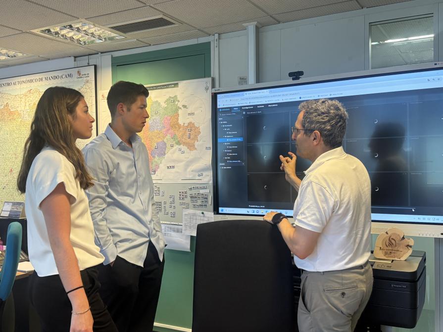
Insights at your fingertips to empower decision-making
The final step in OroraTech’s wildfire detection system delivers critical insights via the Wildfire Solution platform and mobile devices – enabling fast, informed decisions in the field or at command centers.
Our platform provides a holistic view of wildfire risks, active incidents, spread predictions, and post-fire analysis – all in one place.
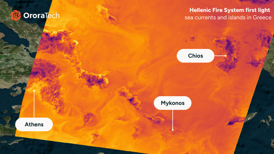
Beyond wildfires: The future of thermal intelligence
With a 30-minute revisit time, our expanding satellite network ensures continuous wildfire detection, closing critical observation gaps worldwide. Governments can integrate custom satellites into our network for country-optimized detection while leveraging global coverage.
Furthering our impact, our Long-Wave Infrared (LWIR) technology will enable Land & Sea Surface Temperature monitoring, driving climate resilience and environmental protection.
Read the latest OroraTech news & updates
Connect with us today
Let’s talk! Whether you’re here to book a demo, explore partnerships, or talk to our press team, we’re just a message away.