Smarter Earth observation: the role of thermal in tip-and-cue systems
Smarter Earth observation: the role of thermal in tip-and-cue systems
As Earth observation technology continues to evolve, the industry is moving away from relying on single sensors and toward systems that combine multiple sources of data. No single modality can provide a complete picture in every condition, which is why modern monitoring increasingly depends on multi-sensor fusion (i.e., many different satellite sensors in the same network or system) - combining thermal, optical, and radar imagery to build faster, more reliable awareness of events happening on Earth.
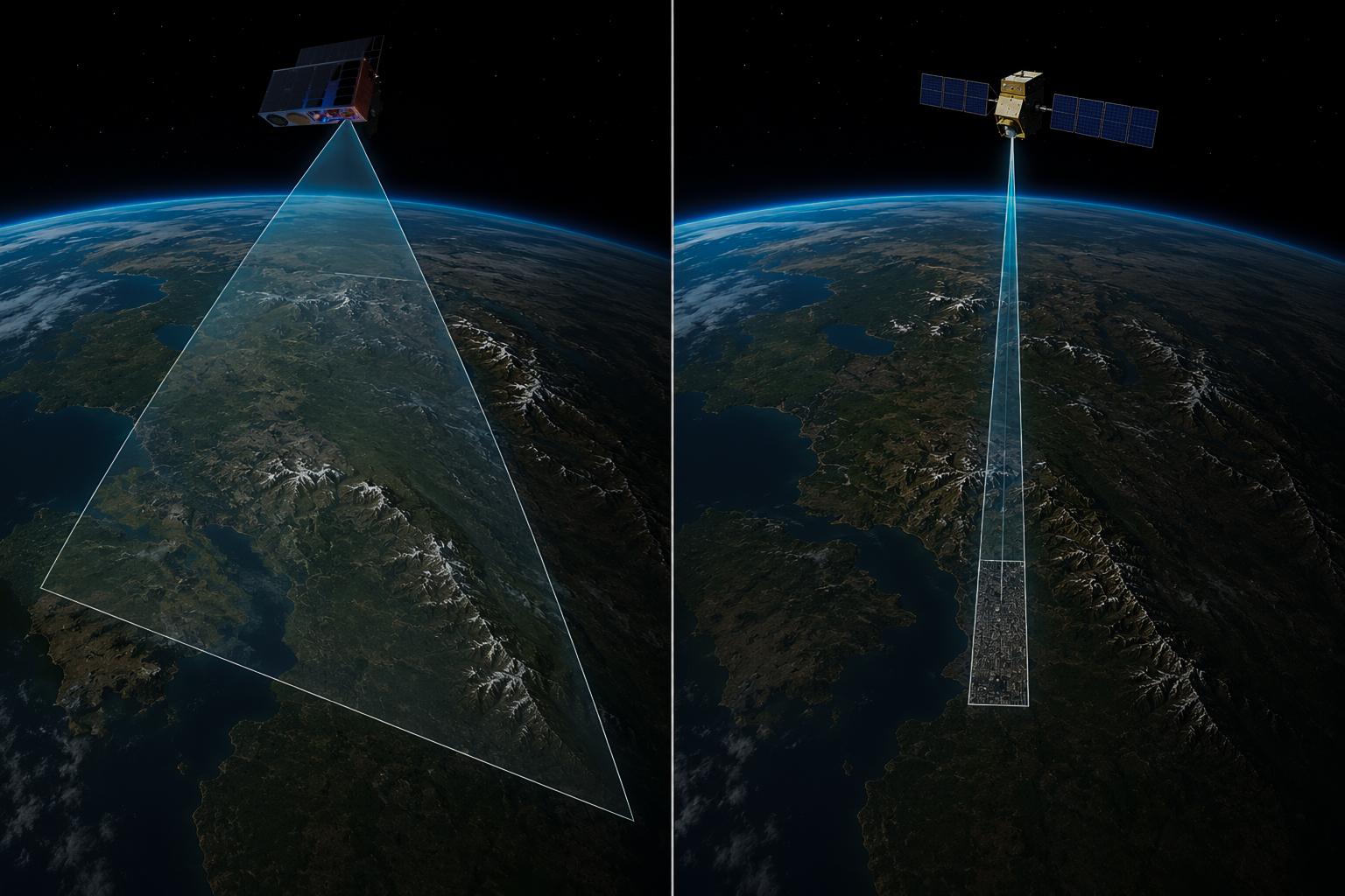
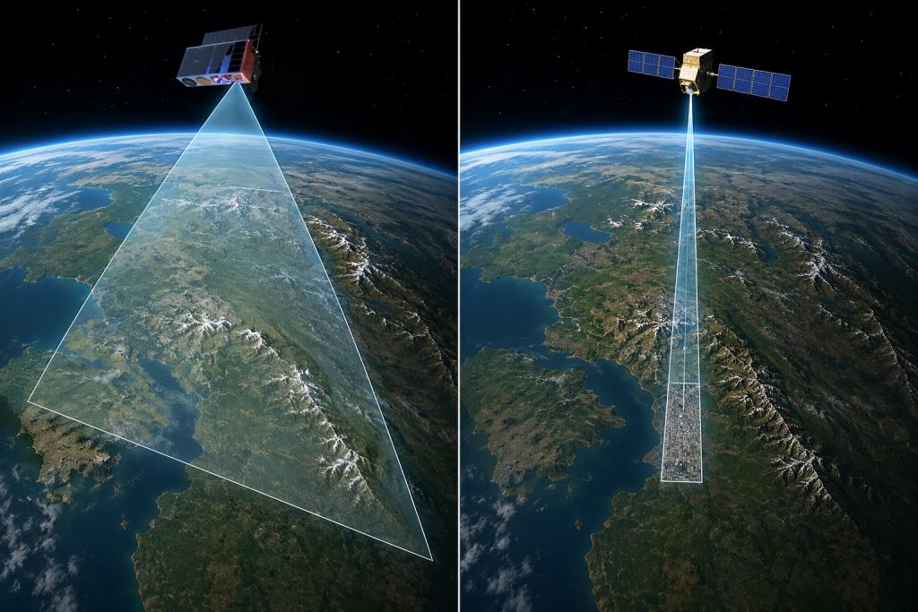
At the center of this shift is a concept known as tip-and-cue.
In simple terms, tip-and-cue is a workflow where one sensor (satellite) identifies a potential event, and another sensor is then tasked to investigate it in greater detail. A wide-area sensor continuously scans large regions looking for anomalies - the “tip” - before triggering a narrower, often higher-resolution asset to “cue” onto the target. This allows satellite systems to monitor enormous areas efficiently while still capturing detailed follow-up imagery when something important occurs.
Thermal & RGB working together
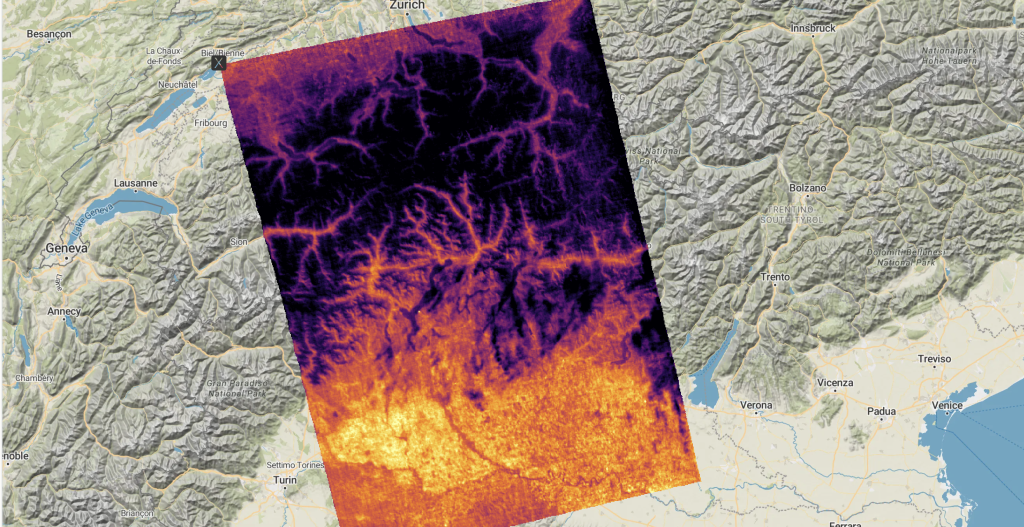
Thermal imagery, and particularly our SAFIRE v3 sensor on board satellites in the atmosphere, is particularly well-suited to this role.
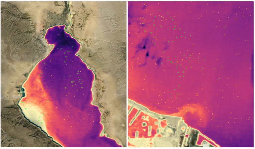
Unlike traditional RGB imagery, thermal sensors measure emitted energy rather than reflected light. That means they can operate at night and are highly effective at detecting heat-based anomalies such as wildfires, industrial activity, shadow fleet ships, volcanic events, or other unusual thermal signatures. In many operational systems, thermal acts as the first layer of awareness by identifying where attention should be directed before other sensors are tasked to provide additional context.
This is where multi-sensor fusion becomes critical.
Thermal data is excellent at finding anomalies quickly, but it does not always explain what those anomalies are. In wildfires, this is easy for us to identify. Other anomalies, not so much. Optical imagery provides the human-readable context that thermal imagery tends to lack. Once an unusual hotspot is identified, RGB or multispectral imagery can reveal infrastructure, terrain, smoke plumes, or environmental impact. Thermal may identify that something is happening; optical imagery helps interpret what that event actually means.
Synthetic Aperture Radar (SAR) & Thermal Together
However, optical systems also have limitations. They depend on daylight and can be obstructed by cloud cover, smoke, or haze. That is why SAR - Synthetic Aperture Radar - plays such an important complementary role in tip-and-cue architectures.
SAR systems can image the Earth day or night and in almost all weather conditions. In situations where optical imagery becomes unusable, SAR continues to provide continuity, helping maintain situational awareness through smoke, cloud, or darkness. This makes SAR particularly valuable during emergency response scenarios, disaster monitoring, defence applications, and rapidly evolving events where persistent visibility is essential.
Together, these technologies form a highly effective observation chain: thermal identifies anomalies, optical imagery adds interpretation, and SAR ensures continuity when visibility conditions deteriorate.
Applications for the Future
These applications are being widely explored for infrastructure monitoring, environmental analysis, disaster response, dual-use applications, and maritime awareness. In all of these cases, the challenge is not simply collecting imagery, but reducing the time between detection and actionable insight.
That is why latency matters just as much as resolution. A high-resolution image delivered too late has limited operational value. Increasingly, the industry is shifting toward architectures that prioritize rapid event detection, automated tasking, and faster downstream response. Advances in onboard processing and AI are also beginning to reduce the time between thermal detection and follow-up collection from hours to minutes - and in some cases, seconds.
As a thermal provider, our role sits at the front of this pipeline.
Thermal data enables the early detection layer that initiates the entire tip-and-cue process. By providing persistent wide-area monitoring and rapid anomaly identification, thermal systems help direct higher-value assets more efficiently and ensure that critical events are identified as early as possible.
As Earth observation systems become more autonomous and interconnected, the importance of thermal within multi-sensor architectures will continue to grow. The future of space-based monitoring is not about a single sensor doing everything - it is about many sensors working together intelligently.
And increasingly, thermal is where that process begins. We are proud to be a part of that process.