2 Years After Smokehouse Creek Fire: What we Learned
2 Years After Smokehouse Creek Fire: What we Learned
Even two years after the event, the Smokehouse Creek fire still feels relevant today. The Texas Panhandle in February 2024 became the epicenter of what would become the largest wildfire in Texas history. The Smokehouse Creek Fire ultimately burned approximately 1,058,482 acres (1,654 square miles / 428,352 hectares) - an area larger than the state of Rhode Island.
Over nearly three relentless weeks, the fire destroyed around 500 structures, killed more than 15,000 cattle, caused an estimated $123 million in damages, and tragically claimed two lives.
But beyond the statistics lies a deeper story - one of how environmental conditions, infrastructure challenges, and operational complexity can converge during extreme wildfire events.
How the Fire Began
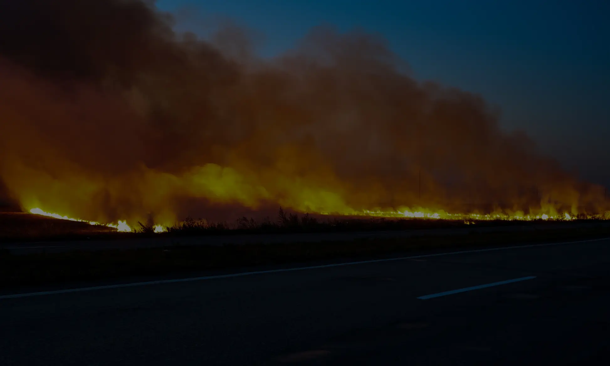
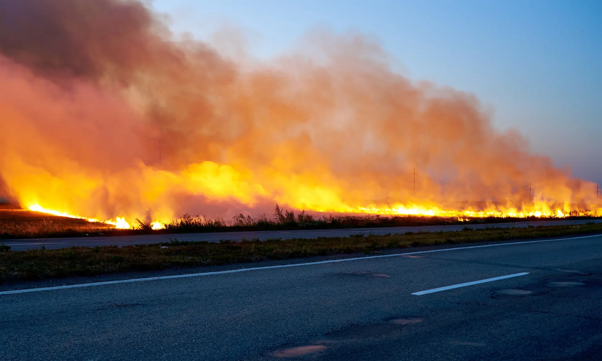
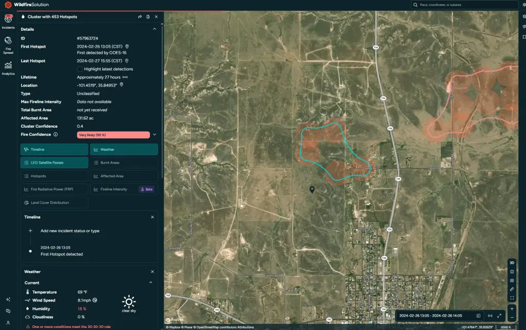
The Smokehouse Creek Fire ignited on February 26, 2024, approximately one mile north of Stinnett, Texas.
An energized power line collapsed after the wooden utility pole supporting it failed due to internal rot. With winds gusting between 30 - 40 mph (50 - 65 kph), the live line fell into dry winter grass, igniting flames almost instantly.
Unseasonably warm temperatures, drought conditions, and powerful winds created the perfect environment for rapid fire growth. What might have been a contained grass fire under normal conditions quickly escalated into a fast-moving wildfire.
Local firefighters received initial reports at approximately 2:20 PM CST. Satellite systems, including GOES-18, had detected thermal activity earlier in the afternoon at around 12:56 PM. With a satellite detection triggering immediate action, response crews may have had a critical window to intervene before the fire’s explosive growth.
Initial Response and Rapid Escalation
When firefighters from Stinnett and Borger arrived on scene, the fire had already spread across thousands of acres. Crews focused on establishing defensible perimeters around structures along Highway 136 while requesting reinforcements and aerial support.
Aerial support is often critical in providing situational awareness during large wildfires. However, high winds and challenging visibility conditions limited aviation effectiveness during the early hours of the incident.
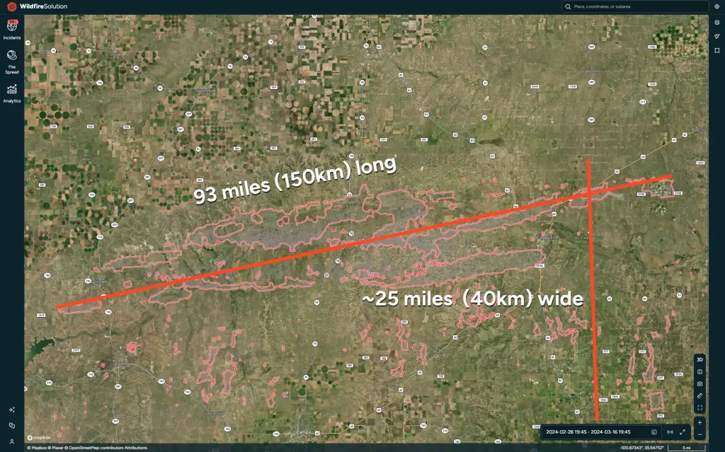
Within just seven hours, the fire was estimated to span nearly 50 miles (80 kilometers).
By the following day, the fire had crossed state lines into Oklahoma and consumed approximately 500,000 acres (202,342 hectares). Containment remained at just 3% by 3:00 PM that afternoon.
See a progression of the fire from ignition to 24 hours below:
A Complex, Multi-Agency Response
As the fire expanded, a multi-agency response was activated. Firefighters from the state forest service, federal agencies, local counties, and volunteer departments converged on the region.
Large-scale incidents of this magnitude inherently introduce coordination challenges. A Texas State Legislature review later noted that communication between local crews, incoming state and federal responders, aviation units, and utility operators became increasingly difficult as the incident evolved. Local firefighters, with the most knowledge and experience with the fire itself, were unable to reliably communicate with incoming state and federal responders, aviation spotters, or utility companies.
These breakdowns resulted in:
Delays in real-time information sharing
Inefficient resource coordination
Slower decisions regarding utility shutoffs
Limited unified situational awareness
At the same time, emergency shutdown protocols at utility facilities were not implemented quickly enough to prevent additional ignitions.
What Could Have Made a Difference?
The Smokehouse Creek Fire shows us three critical gaps:
Detection delays
Fragmented situational awareness
Communication breakdowns between agencies
Wildfires of this size demonstrate how critical real-time situational awareness is during the early stages of an incident.
When smoke limits visibility, and aviation resources are constrained by weather, alternative monitoring systems become increasingly important. Integrated platforms that combine:
Thermal infrared satellite data
Ground-based camera networks
Weather intelligence
Infrastructure monitoring
Real-time perimeter mapping
These can help provide responders with a continuously updated operational view.
Thermal infrared satellites, capable of detecting heat signatures through smoke both day and night, offer valuable perimeter visibility during evolving conditions. When integrated into a shared response system, these tools can support decision-making, resource allocation, and interagency coordination.
See the full progression of the Smokehouse Creek fire over 16 days below:
Lessons from the Largest Fire in Texas History
Studying an extreme example like Smokehouse Creek helps us learn how to do better in the future.
As climate conditions intensify and wildfire behavior grows more extreme, response systems must evolve accordingly.
Early detection must lead to rapid action.
Data must flow seamlessly across agencies.
Infrastructure risks must be proactively identified.
The lessons learned from Smokehouse Creek may help prevent the next wildfire from reaching historic proportions.
Sign up for our newsletter
Read more from OroraTech