Get full access to our Wildfire Solution
You have just viewed a Wildfire Snapshot of a single wildfire cluster. If you want to explore more fires, monitor activity in real time and use all available tools, request a live demo with our team.
Talk to our experts
A snapshot shows only one moment of one fire. A live demo lets you explore the complete platform with our team and understand how it can support your work, region or mission.
What you get with full access
The full Wildfire Solution offers a deep, interactive view of wildfire activity, combining powerful detection, analysis and communication tools used every day by agencies and operators worldwide.
Beyond the smoke
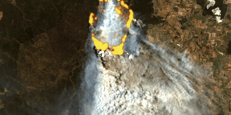
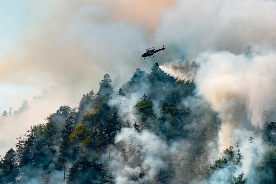
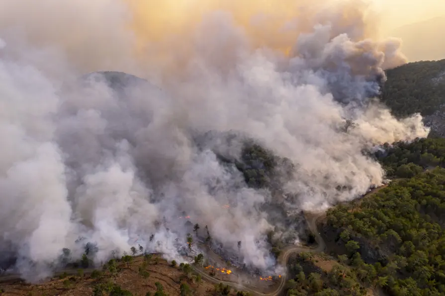
Detect and monitor active fires across wide regions, even under cloud cover or difficult environmental conditions. Gain early awareness of emerging events before they intensify.

Fire Spread
View fire propagation models that help you understand how a fire may develop. Support faster, better informed decisions during high-pressure situations.

Fire clusters
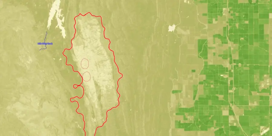
Analyze multiple clusters at once with full event history, perimeter outlines, and detection confidence. Move beyond one snapshot and see the bigger picture.
Land cover
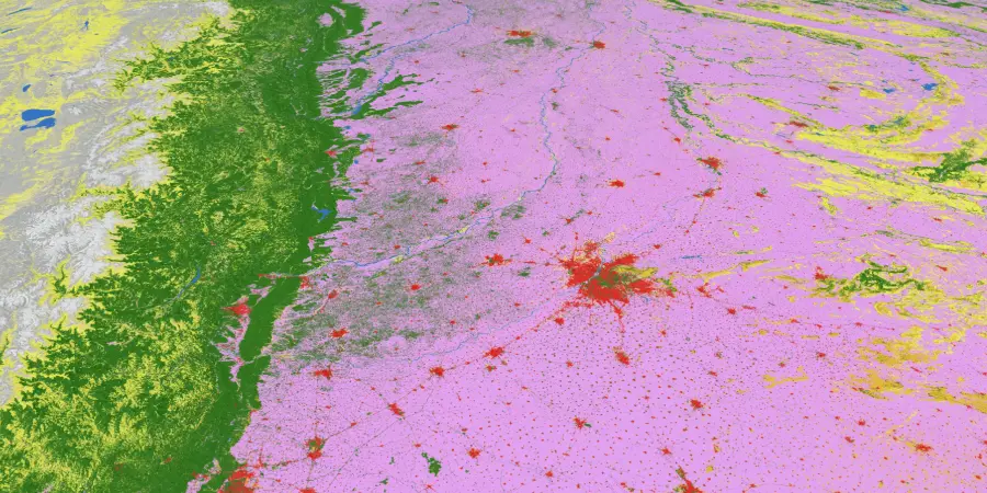
Explore terrain and vegetation layers that influence fire behavior. Understand local conditions that shape how fires grow and spread.
Vegetation damage
Assess burn severity and post-fire conditions to evaluate impact and support recovery planning.

Fuel moisture data
See how flammable vegetation is across regions to anticipate high-risk environments before fires start.

Burnt area
Quantify fire-affected regions and track changes over time to support impact reporting and analysis.
Critical weather factors
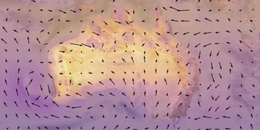
Analyze temperature, humidity, wind speed and more, all in one view, to understand the conditions driving fire behavior.
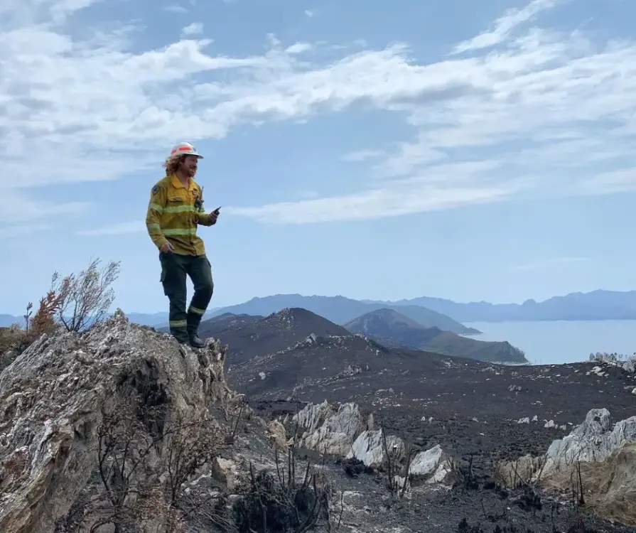
Real stories from teams using the Wildfire Solution
Hear directly from the people who work with us daily. Their experiences show how powerful the platform can be when every minute matters.
European Commission
"What OroraTech has developed is closely aligned with the goals many in the field have been striving toward – a practical, integrated tool for improving wildfire response. The platform brings together an exceptional number of satellite sources, allowing a level of fire monitoring that feels nearly real-time, especially valuable in complex or fast-moving fire situations."

Pietro C., Project Officer – Scientific Research
OroraTech Signs a Multi-Million Contract to Deliver Data to the European Union
Hellenic Fire Service
"OroraTech’s wildfire intelligence has been a great tool for us. We received immediate notifications of almost every new fire, the ones in isolated areas gave us the opportunity to act rapidly, dispatching and managing our resources efficiently. The detection of fires on Greece’s borders with Albania, North Macedonia, and Bulgaria allows us to coordinate water sources and emergency responses across regions. The visualized fire perimeters, especially in the case of Varnavas fire help us realise the development of this EWE. I am looking forward to the future of fire spread modeling, early detection, and so much more!"

Zisoula N., Fire Colonel
SOPFEU Quebec
"We map fires from space when other methods are not possible. OroraTech's Wildfire Solution is an operational mindshift. We never had success with the satellite based data before. In 2023, OroraTech became the main information source for fire detection and monitoring to maintain situational awareness."

Mathieu P., Director of Aviation Services
OroraTech & SOPFEU Working Together to Protect the Unique Forests of Quebec from Wildfires
Tasmania Parks & Wildlife Service
"We were seeking a platform that could help us detect bushfires early. We have found OroraTech to be a great fit for our needs and it is aligned with our organization's mantra of - early detection and rapid response. While others provide satellite data, what sets OroraTech apart is its start-up culture, excellent customer liaison team, and commitment to meeting our needs. Members of the OroraTech team listen to our needs and are consistently improving the platform, we look forward to future developments and enhancements!”

Richard D., Fire Operations Manager
OroraTech & Tasmania Parks and Wildlife Service: Preserving Tasmania's Ecological and Cultural Heritage with Remote Sensing
Find a reseller in your region

Angola


Argentina


Austria


Bosnia-Herzegovina


Botswana

Brazil


Bulgaria


Canada


Chile


Colombia


Croatia


Cyprus


Dominican Republic
Where to buy in Dominican Republic
OroraTech LATAM

Paladius - Industrial Fire Products Corp.

Ecuador

Eswatini

Ethiopia


Germany

India


Indonesia


Italy


Kenya

Madagascar

Malaysia


Malta

Mexico

Montenegro

Mozambique

Namibia

Pacific Community


Paraguay

Peru


Poland


Puerto Rico
Where to buy in Puerto Rico
OroraTech LATAM
Paladius - Industrial Fire Products Corp.

Romania


San Marino

Saudi Arabia


Serbia

Slovakia

Slovenia

South Africa

Switzerland

Tanzania

Thailand


Türkiye


Uganda

United States
Where to buy in United States
OroraTech USA

Santa Clara County FireSafe Council
Team Wildfire

United States Virgin Islands
Where to buy in United States Virgin Islands
Paladius - Industrial Fire Products Corp.

Vatican

Zambia
