Detect. Respond. Protect.
Satellite-based wildfire intelligence for early detection, continuous monitoring, and operational response.
Detect. Respond. Protect.
Satellite-based wildfire intelligence for early detection, continuous monitoring, and operational response.
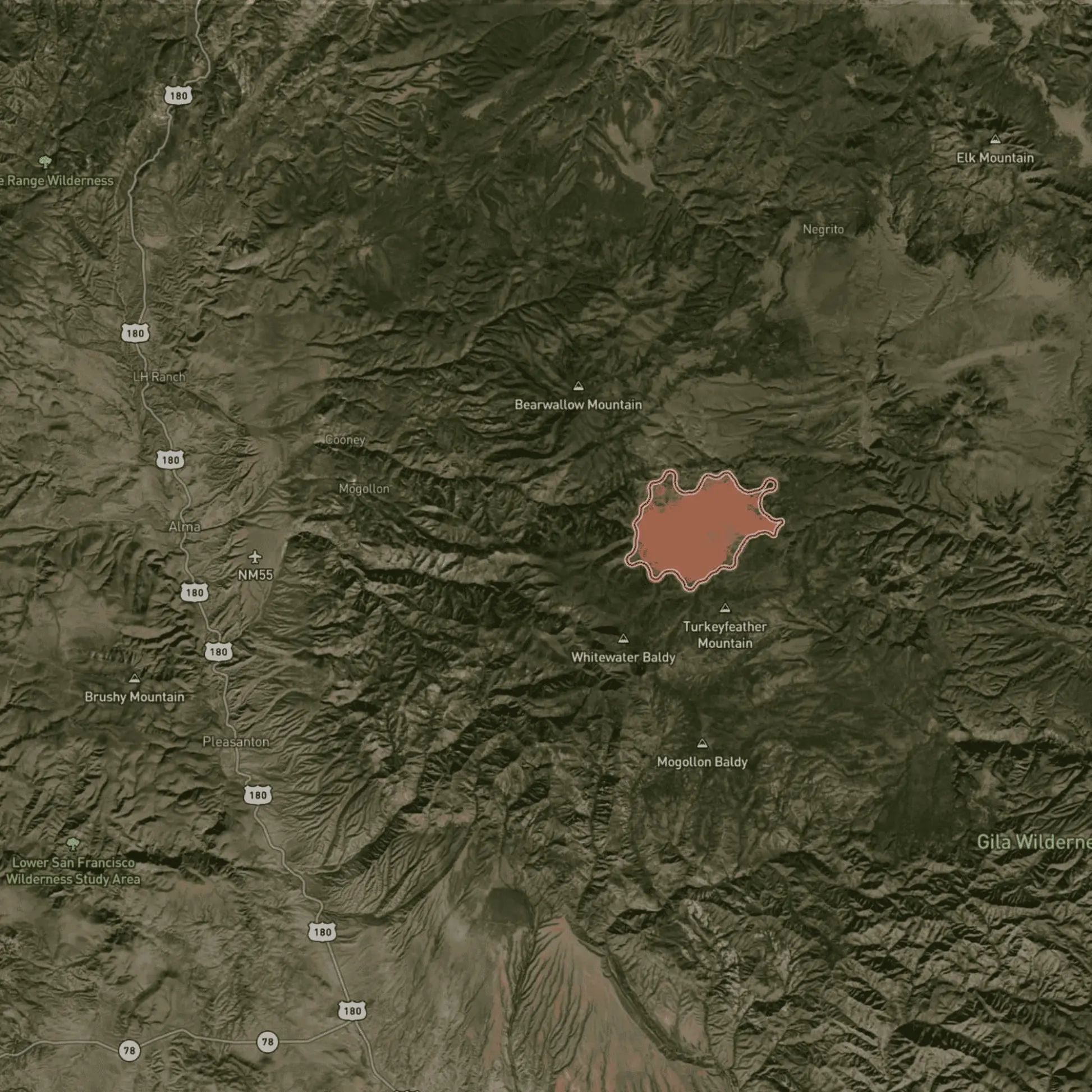
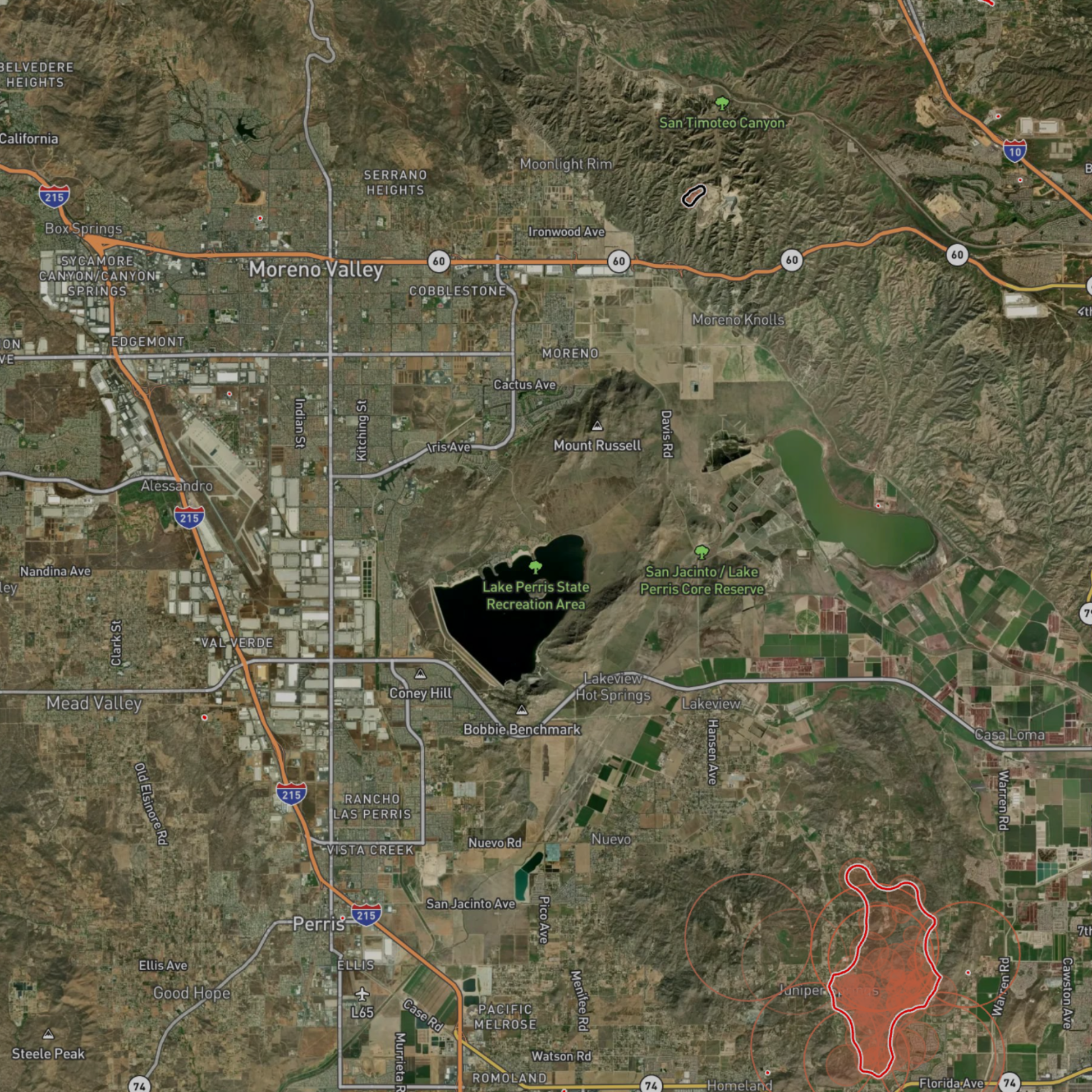
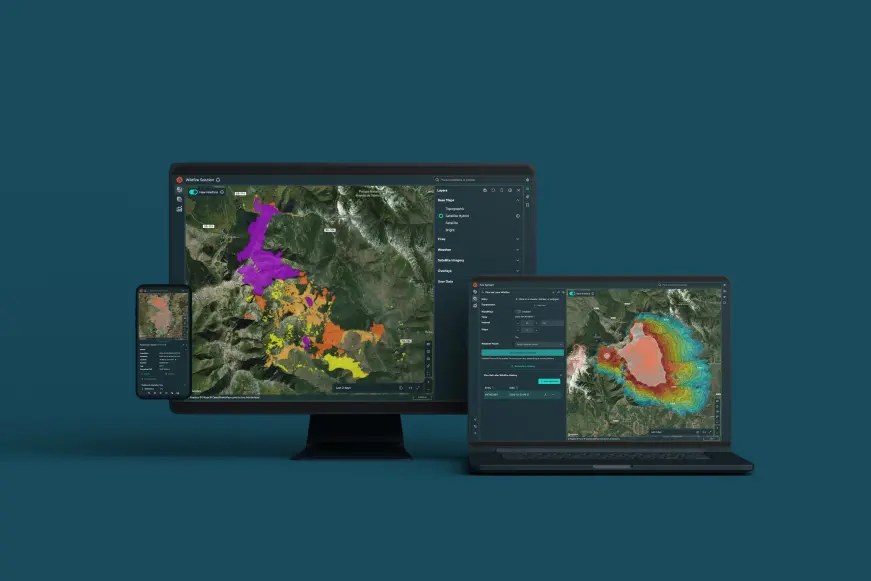
Wildfire snapshot from a real event
This snapshot shows how wildfire activity is detected and visualized in the platform. It provides a view of fire location, intensity, and development at a specific moment in time.
Comprehensive wildfire management
OroraTech supports decision-makers at every stage of wildfire management – before, during, and after – providing the critical information needed to plan actions and protect what matters most. Available in English, Spanish, Portuguese, French & German.
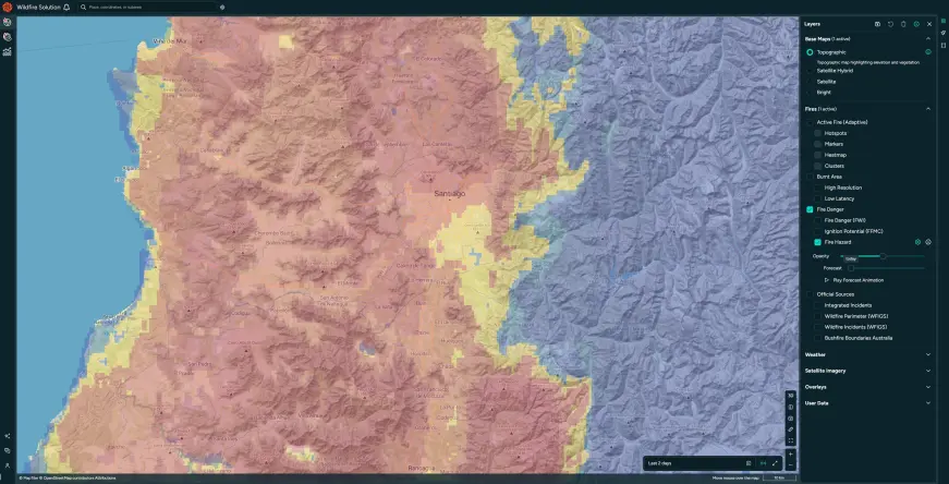
Risk assessment
Predict the fire risk and assess the local weather and vegetation conditions.
Fire Weather index: Access a 9-day forecast and detailed mapping of the fire risk.
Weather information: Stay informed about critical factors including wind speed and direction, temperature, lightning strikes, and humidity.
Vegetation & terrain analysis: Assess conditions using land cover, vegetation indices, and 3D maps.
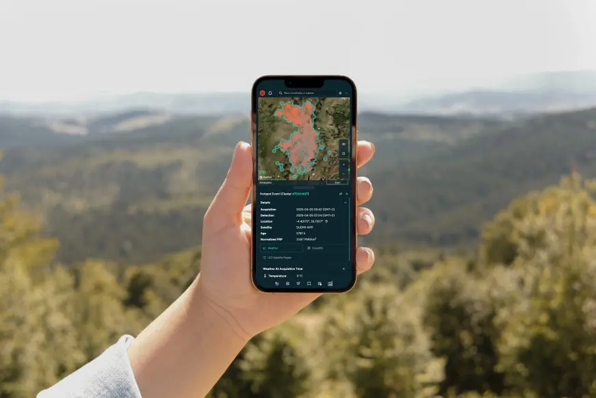
Early detection
Receive instant alerts of active wildfires via different notification methods.
Data from over 25 satellites: Get precise detection and capture fires as small as 10x10 meters.
Automatic notifications: Receive instant email, WhatsApp messages, SMS, or in-app alerts within minutes of any new fire detections in your monitored areas.
Accurate location & fire area: Get precise location coordinates, data on fire intensity, and estimates of the affected area.
Fire confidence: Evaluate multiple factors to confirm if a heat anomaly is a genuine fire, reducing false alarms and enabling timely, cost-effective decisions.
Near-real-time monitoring
Continuous fire tracking: Monitor the active fire front and its development with regular updates.
Fire spread simulation: Benefit from our analysis of crucial fire drivers such as weather, topography, and fuel to estimate the potential fire spread.
Situational awareness: Stay informed with our customizable Incident Overview, displaying only the data you need for effective decision-making.

Post-fire impact analysis
Quantify burnt area automatically and estimate losses.
Burnt area: Utilize advanced technology for high-resolution mapping of burnt areas and severity assessment.
Fire statistics: Uncover patterns and trends in wildfire activity using our comprehensive historical dataset, automatic dashboards, and visualizations.
Fire origin & evolution: Observe fire progression over time.
Talk to our team
Connect with our team to discuss wildfire monitoring, operational use cases, and integration into your workflows.