El Niño and Fire in Southeast Asia: Juan Caamaño on 20 Years in the Field
El Niño and Fire in Southeast Asia: Juan Caamaño on 20 Years in the Field
El Niño and Fire in Southeast Asia: Juan Caamaño on 20 Years in the Field
El Niño and Fire in Southeast Asia: Juan Caamaño on 20 Years in the Field
Most people encounter El Niño as a weather headline - a seasonal anomaly noted in forecasts and then forgotten. Its connection to wildfire activity across Southeast Asia is more direct, and more measurable, than that framing suggests. Forecasters expect 2027 to bring one of the most severe El Niño events in recent memory, and the consequences for fire risk in the region will be significant.
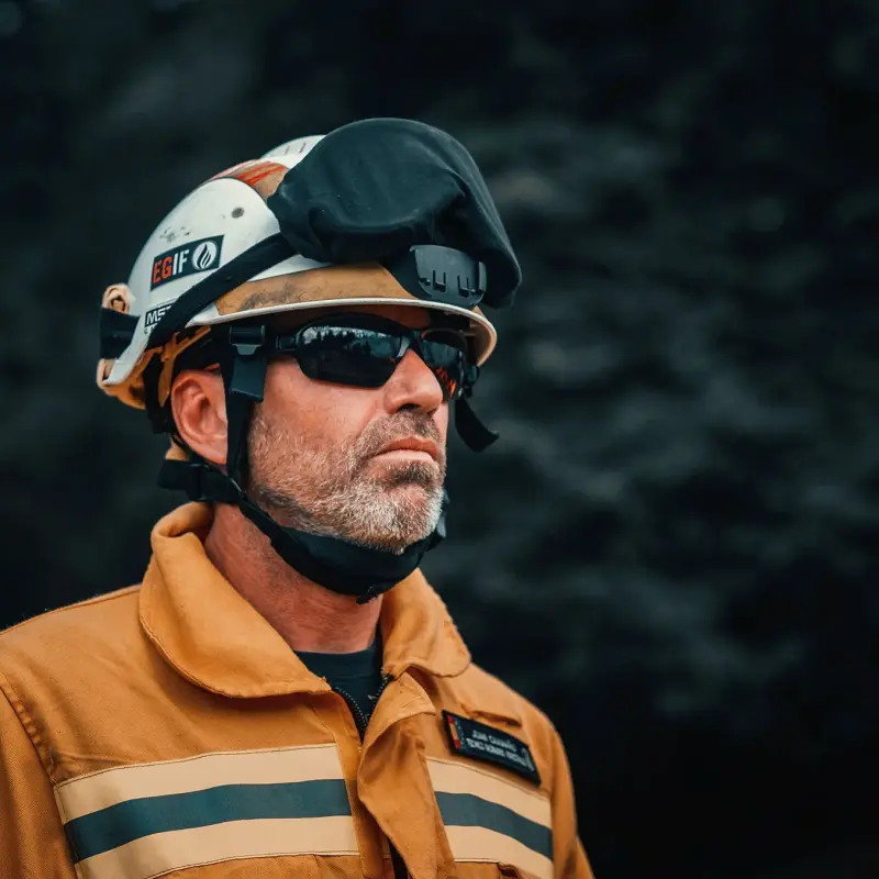
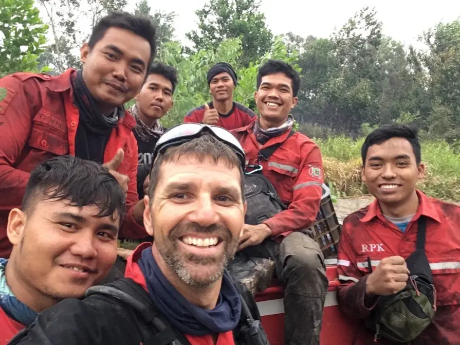
Juan Caamaño, Head of Training & Operations at the Pau Costa Foundation
Juan Caamaño has spent more than 20 years working in heavy wildfire operations as a forestry engineer and fire behavior analyst with the Pau Costa Foundation. His field experience spans Indonesia - including Borneo and South Sumatra - along with Latin America and Europe. He currently leads a five-person training and operations team focused on fire analysis, fire weather, and prescribed burning. Based on his experience, we wanted to understand what El Niño actually does to fire risk, why tropical peatland fires are uniquely dangerous, and what communities, companies, and governments can do before the next event arrives.
El Niño's Effect on Fire Risk, Explained
El Niño is a climate event that shifts prevailing wind patterns from easterly to westerly. In simple terms, that means humidity that would normally reach Southeast Asia gets redirected toward South America instead. The region experiences less precipitation, and it happens quickly. That transition from normal conditions to drought can happen within a matter of weeks.
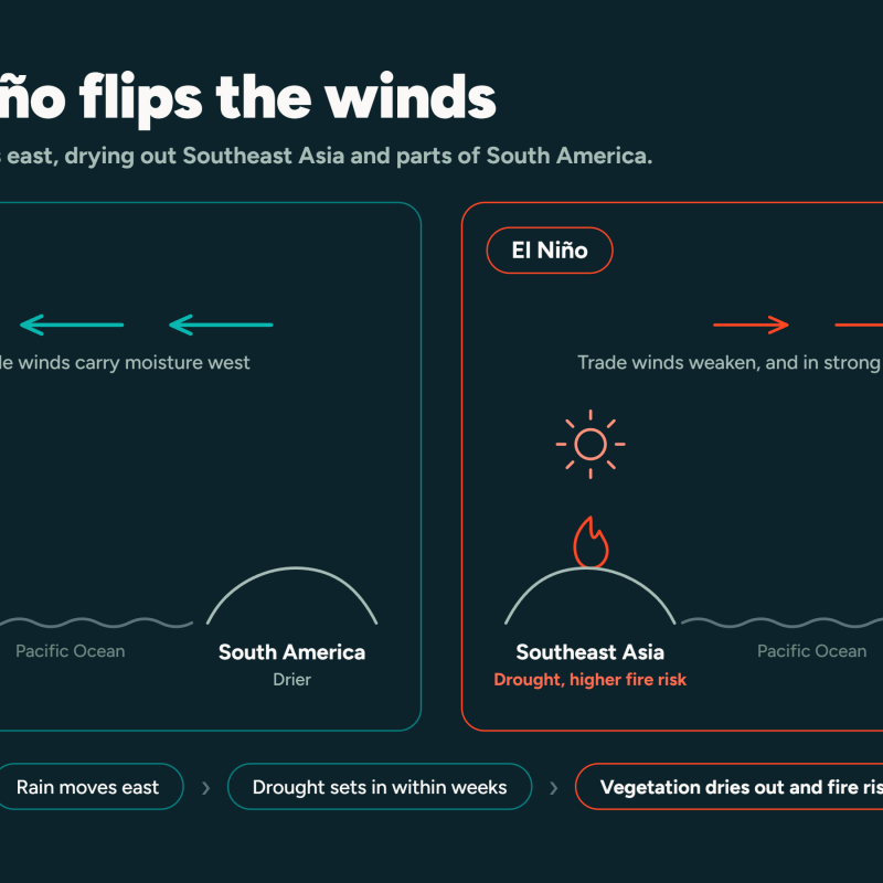
A description of how El Niño changes wind patterns, affecting Southeast Asia
Less humidity leads to drought. Drought leaves vegetation dry and primed to burn. That chain of wind shift, humidity loss, drought, and dry fuel is what turns a climate pattern into an extreme fire season. Caamaño is direct about the speed of that transition in tropical environments: even 15 days without precipitation is enough to change fuel availability dramatically. Shallow root systems and intense solar radiation dry out surface vegetation faster than most people expect. What looks like a green landscape can become fire-ready in a very short window.
That cause-and-effect chain is consistent enough that analysts can use El Niño forecasts to anticipate fire risk well in advance. The challenge is acting on those forecasts before the dry season begins.
El Niño on the Ground: Indonesia up Close
Caamaño has worked directly in South Sumatra and conducted remote assessment work during active fire emergencies, using satellite data, weather models, and high-resolution forecasting tools to track fire movement in real time. The geographic scale of what fires cover during active El Niño years is difficult to convey through maps or statistics alone.
"I've never seen anything like that in my life," he said. "Nothing like Indonesia. It's just tremendous, the amount of fires."
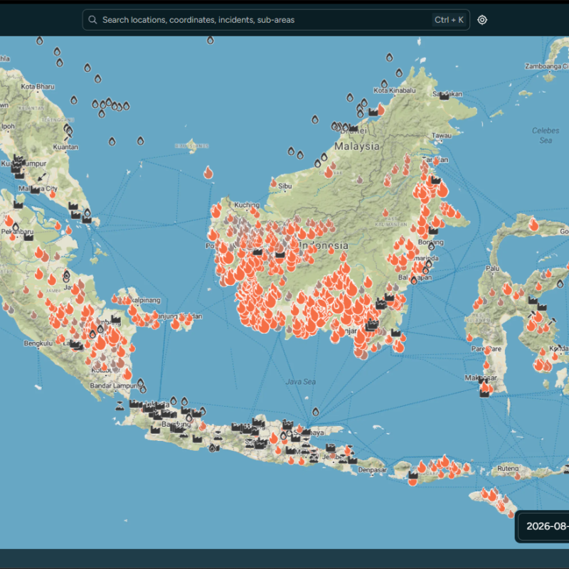
All fires within Indonesia from August 9th to August 16th, as seen within Wildfire Solution.
That description reflects what analysts encounter when El Niño drives drought conditions across Borneo, South Sumatra, Malaysia, Thailand, and Myanmar simultaneously. These are not isolated events. Fires ignite across a vast landscape, often faster than suppression resources can be deployed, and the cumulative effect - on air quality, on ecosystems, on communities - compounds quickly. Understanding why requires looking at what makes tropical fire behavior categorically different from the fire regimes most suppression systems are built to handle.
The Unique Danger of Peatland Fires
Peat fires burn underground. That single fact changes almost every aspect of how they are detected, fought, and ultimately extinguished. It is what makes them so much more hazardous than surface fires of equivalent visible size.
A surface crew can declare an area clear while fire continues smoldering beneath it for weeks. The fire spreads through the peat layer without oxygen in the way above-ground fires require it, which means conventional suppression approaches like aerial retardant and surface dozer lines address the symptom while the cause continues underground. Containing a peat fire often requires heavy machinery to excavate containment lines around the burning area, a process that can take weeks to execute while new ignitions continue elsewhere.
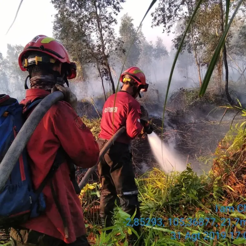
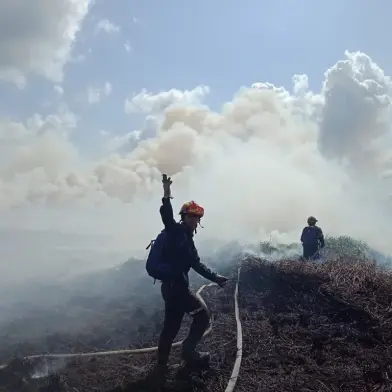
Peatland fire demands a unique way to fight fires. In this case, a trench was dug to uncover the embers and water sprayed to extinguish.
The health consequences extend far beyond the fire perimeter. Peat combustion releases a toxic haze that can linger over a region for weeks or months, well beyond the life of the visible flame front. This is not ordinary wildfire smoke. It is a sustained, low-visibility, high-toxicity air event with measurable effects on respiratory health, on transport systems, and on public life across multiple countries at once. The 2015 El Niño season in Indonesia produced haze conditions severe enough to trigger regional health crises across international borders. Conditions of that scale are not an anomaly. They are what uncontrolled peat fire looks like during a strong El Niño event.
The Forces Behind Ignition
Two human forces drive ignition in the region: slash-and-burn agriculture and corporate land concessions. Clearing land by fire is cheap, fast, and effective, which is why the practice persists despite the risk it creates at a regional scale.
For local communities, fire is a tool tied directly to livelihood. Burning cleared land for rice cultivation is a long-established practice, and for many communities it is the most accessible option available. The socio-economic drivers behind it are real and should be understood as such, not dismissed as simple negligence.
This same economic driver has a different dimension as well. Government-granted concessions for palm oil, eucalyptus, and acacia production are frequently cleared using fire, because it is the fastest and cheapest method available. The land involved often overlaps with or borders indigenous and local community territory, creating friction that runs deeper than fire management. Land displacement generates conflict, and fire becomes a tool of that conflict — used as leverage by communities pushing back against corporate land acquisition.
Fire also functions as political leverage beyond local disputes. "Fire is a political tool," Caamaño said, "and it's becoming a more and more political tool." That observation holds across geographies. In Chile, as in Indonesia, fire has been used as a form of organized resistance. Suppression alone cannot change why fires are set. Prevention strategies that address land-use incentives and land rights are a prerequisite, not an afterthought.
When Haze Crosses Borders
Smoke does not stop at a border. Haze originating in Indonesia regularly drifts into Singapore and Malaysia, where it triggers public health advisories, forces school and airport closures, and strains regional relationships. What begins as a forestry and land-use issue inside one country's borders becomes a diplomatic problem at the international level.
The pressure on the Indonesian government from this pattern is substantial. It sits between domestic economic reliance on land-clearing practices and mounting criticism from neighboring countries, international health organizations, and global environmental bodies. That tension is not new, with the 2015 season drawing wide international attention, but the structural incentives that drive it have not fundamentally changed. Until the economic calculus around land clearing shifts, the diplomatic friction is likely to recur with each major El Niño event.
How Technology Is Reshaping Fire
Satellites now track the radiative power of a fire, giving analysts a view of fire intensity and growth patterns. Twenty years ago, this kind of situational awareness simply did not exist. Today, it is accessible.
However, that technology and data is not a real focus in the region. In Juan’s view, incident commanders remain focused on resource management, like tracking personnel hours, equipment positions, helicopter refueling cycles, rather than acting on behavioral forecasts and data that could inform strategy before conditions worsen.
That is a real problem. Better data alone does not solve it. The data has to be interpreted, communicated to the right decision-makers, and acted on within a narrow window before fire conditions change. Technology addresses the information side of that equation. Operational culture and institutional structure determine whether the information translates into action. Both matter, and currently, they are not moving at the same pace.
What Real Fire Preparedness Looks Like
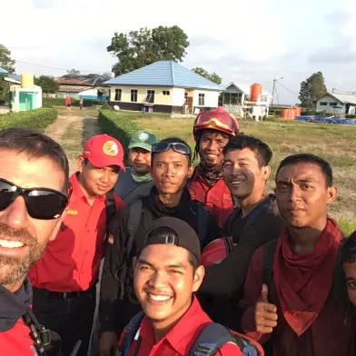
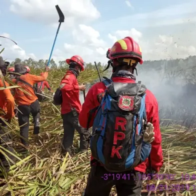
Two practices stand out in Caamaño's experience. The first is community engagement, specifically, employing residents as firefighters. Local communities know the terrain, understand seasonal patterns, and have a direct stake in protecting the land around them. Companies operating in concession areas that have adopted this model have seen measurable reductions in ignitions. The approach addresses both the operational and the social dimensions of fire risk simultaneously.
The second is integrated fire management. The instinct in many policy environments is to ban slash-and-burn practices outright. That approach tends to push the practice underground rather than eliminate it, and it removes any opportunity to influence how communities use fire. Teaching communities to use fire deliberately and safely is a more durable strategy, using fire at the right time, in the right conditions, for the right purpose, and with the right equipment. It requires investment and coordination, but it treats fire as something to be managed rather than something to be forbidden.
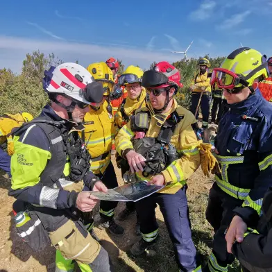
Equipment investment matters too, but it has limits. Fast aerial response is valuable. It is not a complete answer if the root causes of ignition - land conflict, economic pressure, absence of alternatives - remain unaddressed. Caamaño's experience suggests that preparedness is most effective when it combines early detection, community-based response, and structural approaches to ignition prevention, rather than leaning on any single element.
Preparing for 2027
Forecasters expect 2027 to bring a significant El Niño event. The pattern described throughout this piece - wind shift, drought, dry fuel, widespread ignition - will happen again, and at abnormal strengths. The question is not whether conditions will intensify. It is whether the region will be in a better position to respond when they do.
The tools already exist: satellite monitoring with near-real-time data, community-based firefighting models with a track record of reducing ignitions, and integrated land-use approaches that address the social drivers of fire rather than just the flames themselves. What those tools require is early adoption: before the dry season begins, not after fires are already spreading. Workflows built under emergency conditions are less effective than workflows built in advance. That applies to technology platforms, response protocols, and community agreements alike.
The dry season will arrive on schedule. Whether the region's institutions, companies, and communities are ready for it is a choice that gets made now, not when the smoke is already visible.
FAQ
What causes El Niño to increase wildfire risk in Southeast Asia?
El Niño shifts prevailing winds from easterly to westerly, redirecting humidity away from Southeast Asia toward South America. This produces drought conditions that dry out surface vegetation and peatland rapidly, creating fuel for wildfires. Even a short dry spell — as few as 15 days — can significantly change fuel availability in tropical environments.
Why are peatland fires harder to manage than surface fires?
Peat fires burn underground, which makes them difficult to detect and extinguish. They can smolder for weeks after a surface fire appears to be out, and conventional suppression methods - aerial retardant, surface dozer work - do not address the underground combustion. Containing a peat fire typically requires excavating containment lines with heavy machinery, a slow and resource-intensive process. The toxic haze they produce also lingers far longer than visible smoke from above-ground fires.
Who is responsible for starting most fires in the region?
Fires are commonly linked to slash-and-burn agriculture practiced by local communities and to corporate land clearing for palm oil, eucalyptus, and acacia plantations. Fire is also used as a form of political leverage in land disputes between corporate concession holders and indigenous or local communities, a dynamic Caamaño has observed directly in the field.
What role does satellite technology play in fire management?
Satellites can track radiative power of a fire, giving analysts near-real-time data on fire intensity and spread. This data supports the construction of visuals that can project fire perimeter growth hour by hour, enabling behavioral forecasts. The remaining challenge is converting that data into timely operational decisions on the ground.
When is the next major El Niño event expected?
Forecasters anticipate a significant El Niño event in 2027, which is expected to bring elevated wildfire risk across Southeast Asia. Analysts with experience in the region recommend beginning preparedness work now, well ahead of the dry season.
Stay in orbit with OroraTech - sign up for our newsletter
Read more about OroraTech
El Niño and Fire in Southeast Asia: Juan Caamaño on 20 Years in the Field

OroraTech books 10 more thermal payloads on Kepler's Tranche 2, taking its hosted fleet on the optical relay operator to 15