OroraTech webinar: Building fire-resilient projects with Permian Global
Dive back into the conversation on building wildfire-resistant carbon programs. Explore real-world insights, data-driven strategies, and guidance from Permian Global and OroraTech to strengthen projects with next-generation wildfire intelligence.
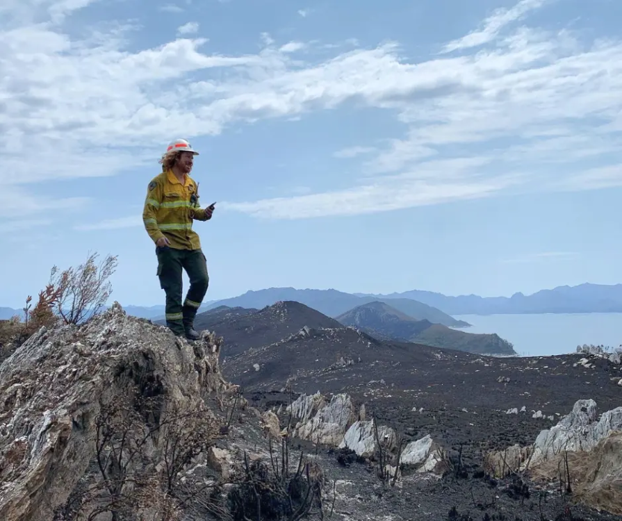
Building wildfire-resistant carbon programs
Explore the full conversation between Permian Global and OroraTech on how advanced fire intelligence strengthens carbon project stability. The session walks through real project risks, practical mitigation strategies, and data-driven approaches for long-term resilience. Sit back, press play, and take what you need for your own program design, monitoring, and reporting.
See how wildfire intelligence elevates your carbon projects
Ready to explore the tools behind the webinar? Our team will walk you through real-time fire detection, project monitoring workflows, and the analytics that support permanence and risk mitigation. Tell us a bit about your work, and we’ll tailor the demo to your project needs.
Learn more about our platform
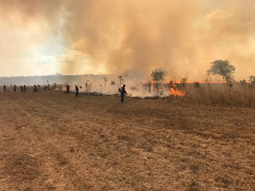
A single platform built to detect, monitor, and manage wildfire risk in real time. Trusted by carbon developers, conservation teams, insurers, and governments worldwide.
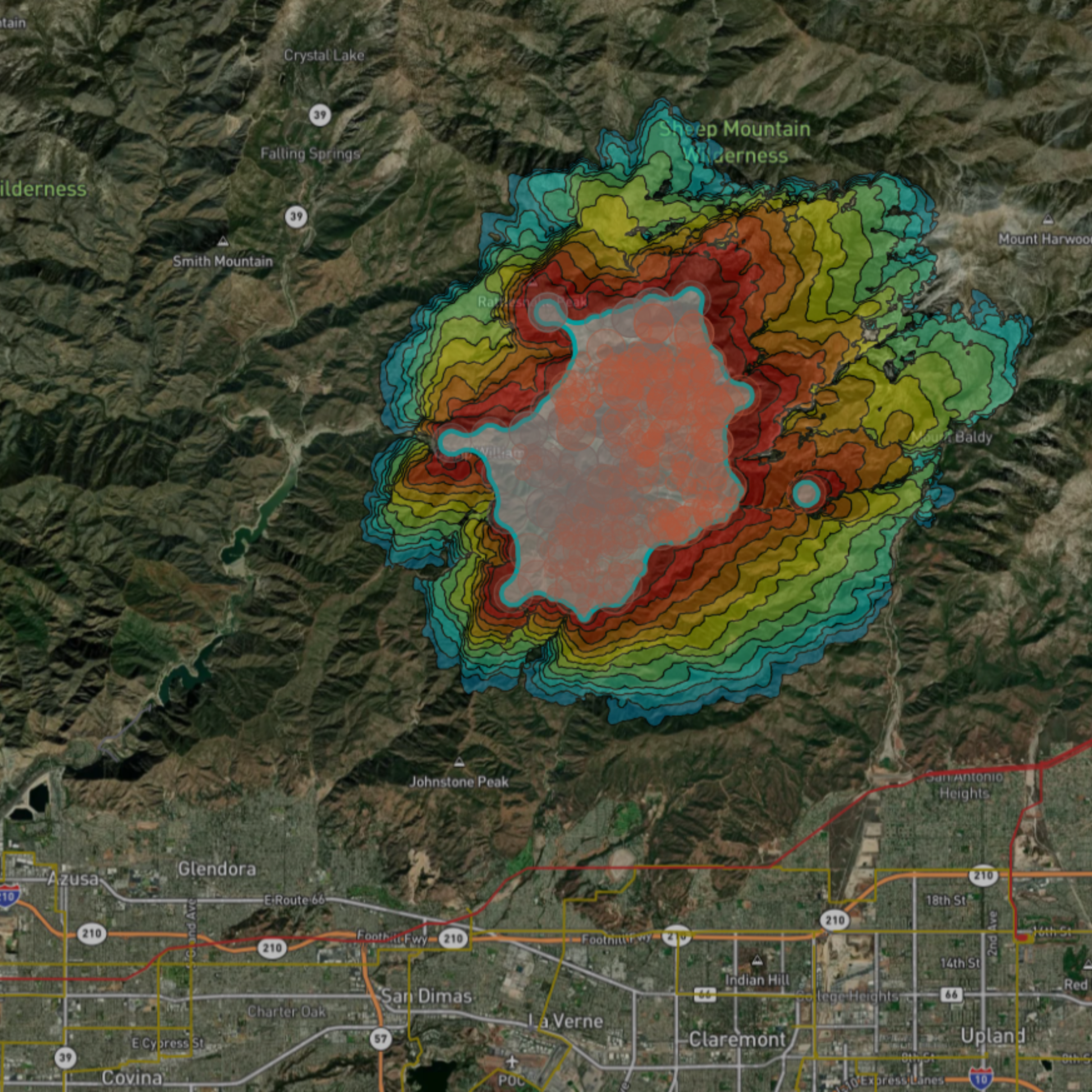
Risk assessment
Predict the fire risk and assess the local weather and vegetation conditions.
Fire Weather index: Access a 9-day forecast and detailed mapping of the fire risk.
Weather information: Stay informed about critical factors including wind speed and direction, temperature, lightning strikes, and humidity.
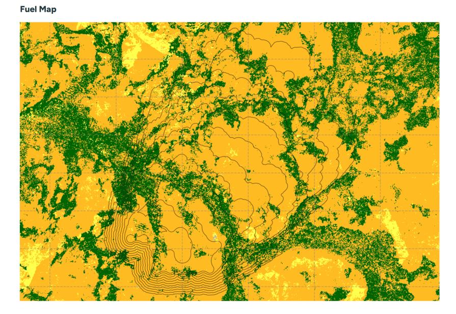
Vegetation & terrain analysis: Assess conditions using land cover, vegetation indices, and 3D maps.
Early detection
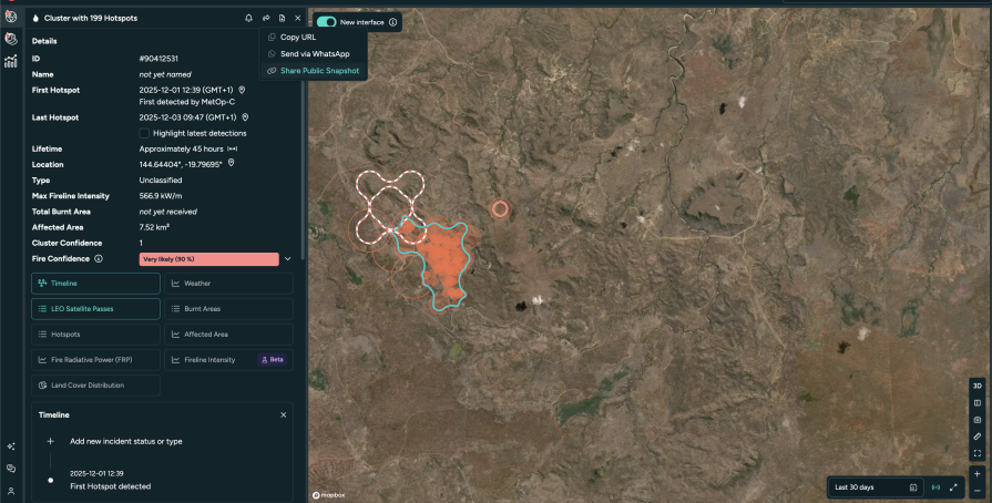
Receive instant alerts of active wildfires via different notification methods.
Data from over 25 satellites: Get precise detection and capture fires as small as 10x10 meters.
Automatic notifications: Receive instant email, WhatsApp messages, SMS, or in-app alerts within minutes of any new fire detections in your monitored areas.
Accurate location & fire area: Get precise location coordinates, data on fire intensity, and estimates of the affected area.
Fire confidence: Evaluate multiple factors to confirm if a heat anomaly is a genuine fire, reducing false alarms and enabling timely, cost-effective decisions.
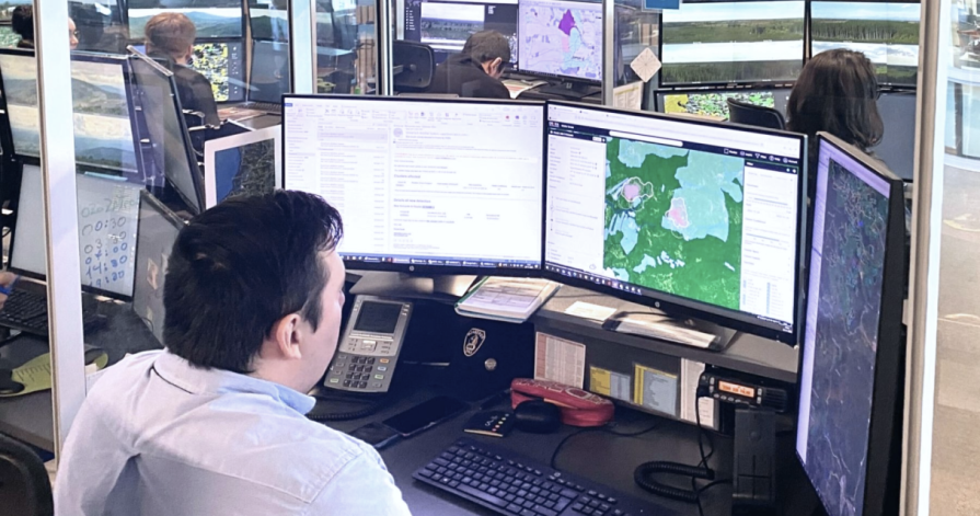
Near-real-time monitoring
Continuous fire tracking: Monitor the active fire front and its development with regular updates.
Fire spread simulation: Benefit from our analysis of crucial fire drivers such as weather, topography, and fuel to estimate the potential fire spread.
Situational awareness: Stay informed with our customizable Incident Overview, displaying only the data you need for effective decision-making.
Post-fire impact analysis
Quantify burnt area automatically and estimate losses.
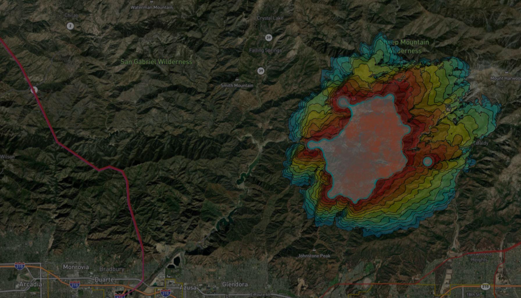
Burnt area: Utilize advanced technology for high-resolution mapping of burnt areas and severity assessment.
Fire statistics: Uncover patterns and trends in wildfire activity using our comprehensive historical dataset, automatic dashboards, and visualizations.
Fire origin & evolution: Observe fire progression over time.
Trusted by industry leaders across the globe

ARAUCO Chile
“OroraTech’s data and team support enabled our team to concentrate on the crucial task of combating the fires, especially at night when visibility and aircraft resources are scarce for having an overall overview of the situation.”

German N., Head of Forest Fire Protection
OroraTech & ARAUCO: Battling Devastating Fires in Chile
SOPFEU Quebec
"We map fires from space when other methods are not possible. OroraTech's Wildfire Solution is an operational mindshift. We never had success with the satellite based data before. In 2023, OroraTech became the main information source for fire detection and monitoring to maintain situational awareness."

Mathieu P., Director of Aviation Services
OroraTech & SOPFEU Working Together to Protect the Unique Forests of Quebec from Wildfires
European Commission
"What OroraTech has developed is closely aligned with the goals many in the field have been striving toward – a practical, integrated tool for improving wildfire response. The platform brings together an exceptional number of satellite sources, allowing a level of fire monitoring that feels nearly real-time, especially valuable in complex or fast-moving fire situations."

Pietro C., Project Officer – Scientific Research
Tasmania Parks & Wildlife Service
"We were seeking a platform that could help us detect bushfires early. We have found OroraTech to be a great fit for our needs and it is aligned with our organization's mantra of - early detection and rapid response. While others provide satellite data, what sets OroraTech apart is its start-up culture, excellent customer liaison team, and commitment to meeting our needs. Members of the OroraTech team listen to our needs and are consistently improving the platform, we look forward to future developments and enhancements!”

Richard D., Fire Operations Manager
OroraTech & Tasmania Parks and Wildlife Service: Preserving Tasmania's Ecological and Cultural Heritage with Remote Sensing
USFS Niassa National Reserve
"The Niassa Special Reserve in northern Mozambique faces a huge problem of forest fires that every year cause environmental, social, and economic damages. Thanks to OroraTech's WFS we are able to monitor the wildfires as well as gather the information needed to analyze their spatio-temporal pattern which is a very important component for the designing of an integrated fire management plan to address this problem within this conservation area."